Calculate Distances Between Locations on Your Custom Maps

Research by Scientific American shows that humans are not very good at estimating distances. Luckily, we have computers to help us much of the time, such as our vehicle’s GPS or driving directions on a website. It’s only natural that you’d also want to use these with your own custom locations. These distance calculations can be important in many cases, from sales and customer visits to deliveries. One error could mean a lot of time, not to mention money, wasted.

Instead of calculating distance manually or relying on scientifically proven poor estimates, use tools that take out all of the guesswork.

Let’s go over one such tool, our mapping software, which has multiple ways of determining the distance between your points, starting with point selection.

1. Select Your Points

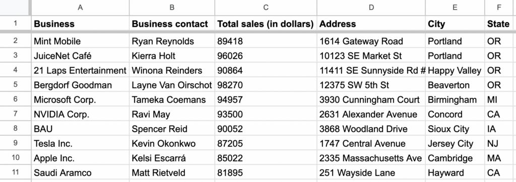
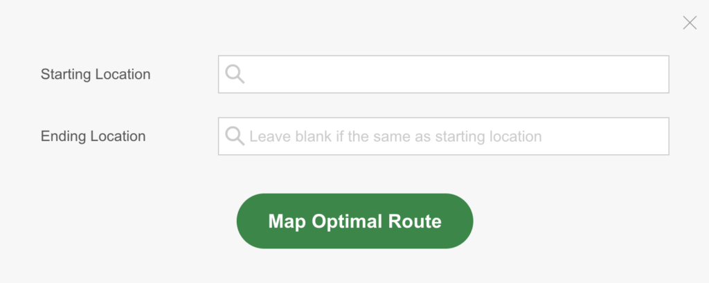
Let’s start by selecting the locations on your map that you want to calculate the distance between. If you don’t already have a map, here’s how to prepare the data of your choice for our copy-and-paste mapping tool.

There are multiple ways you can select your points, including:

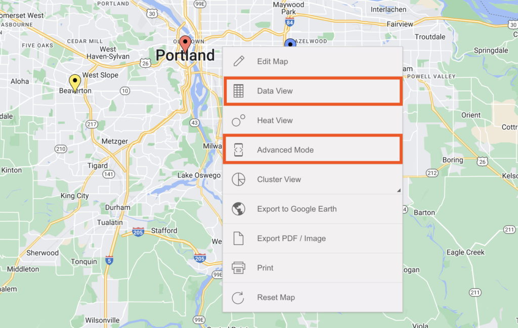
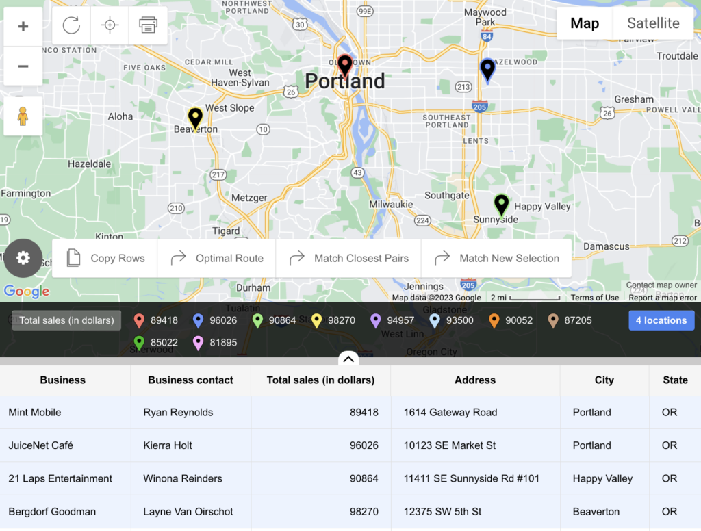
  • Selecting rows on a table via Data View
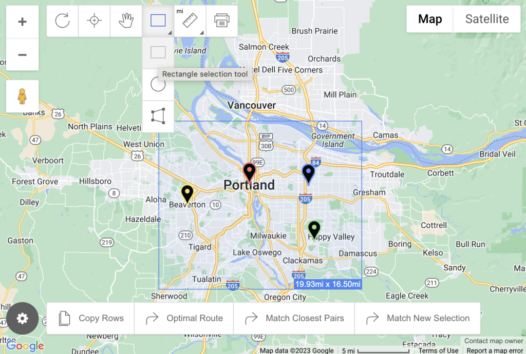
  • Using Advanced Mode’s selection tool shapes:
    • Rectangle
    • Circle
    • Polygon

Right-click (or hold control and click on Mac) any BatchGeo map to bring up additional ways of viewing (i.e. Data View) along with other options. If you’re a BatchGeo Pro user, among these is Advanced Mode.

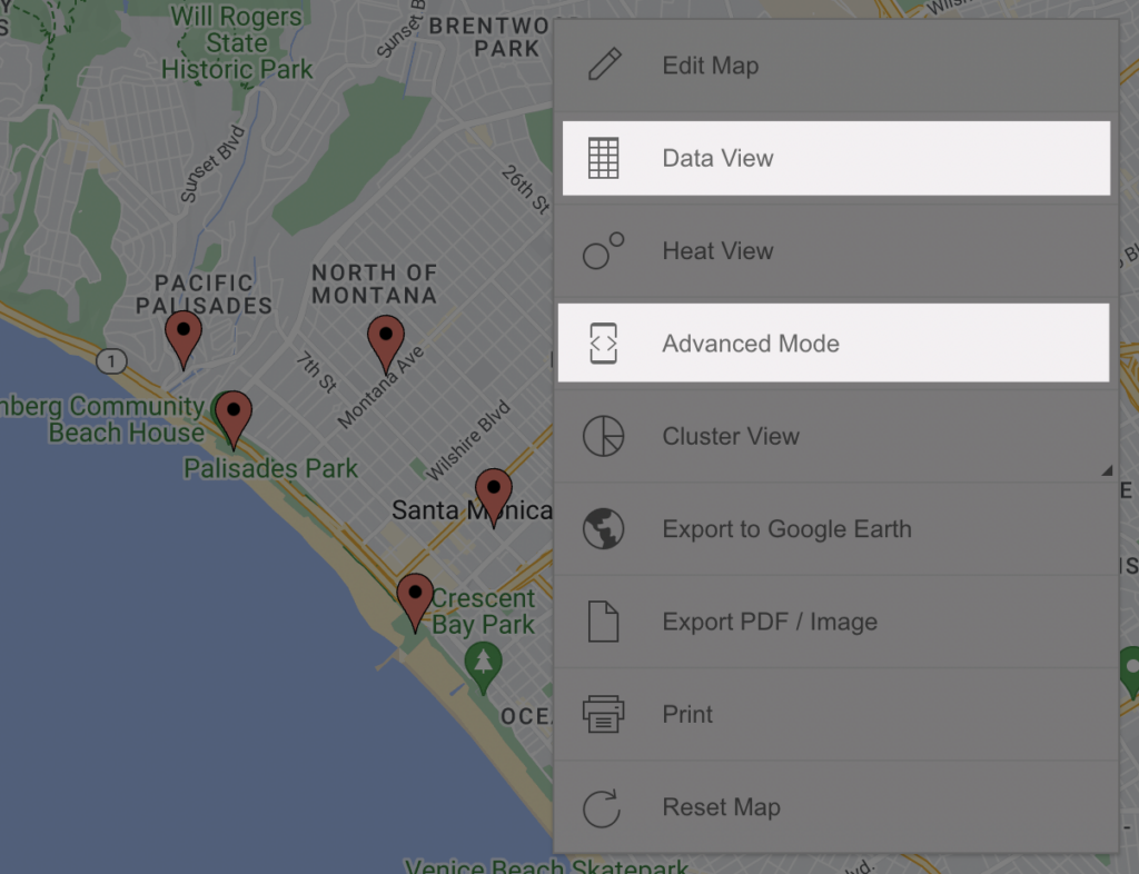
You can use either Data View or Advanced Mode to select your points for distance calculations.

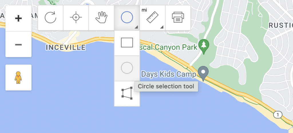
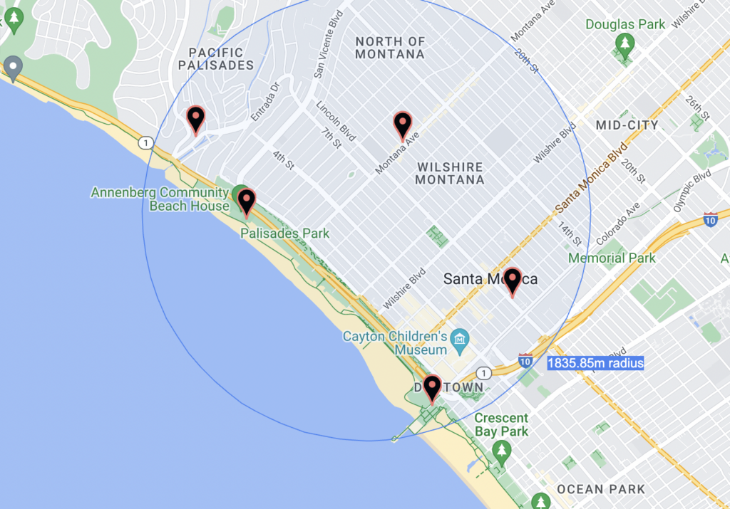
Advanced Mode will reveal even more selection tools in the upper left-hand corner of your map (the Rectangle, Circle, and Polygon selection tool). Choose a shape and then draw it to capture your points.

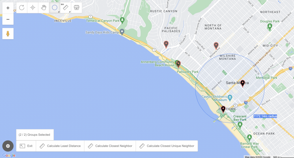
Depending on which of the distance calculation tools you want to use, you’ll select one or two groups of points.

2. Calculate Distances Multiple Ways

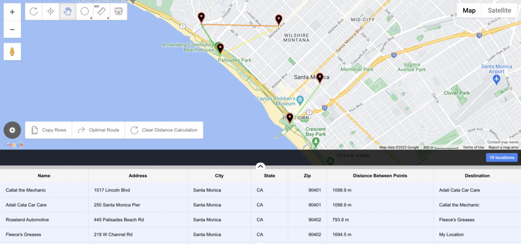
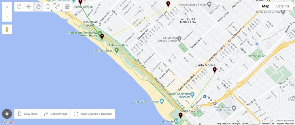
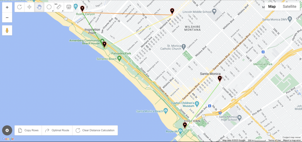
With our points selected, we can now move on to using our various distance calculation tools: Match Closest Pairs, Match New Selection, and the multi-distance tool.

Match Closest Pairs

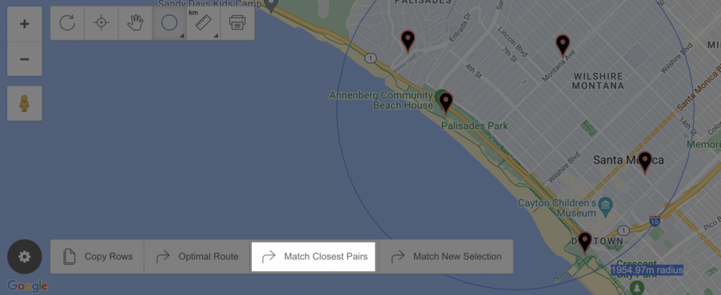
Once you select your points, you’ll see options near the bottom of your map. Choose Match Closest Pairs if you wish to use only your currently selected points. Then, pick from one of the following options that pop up:

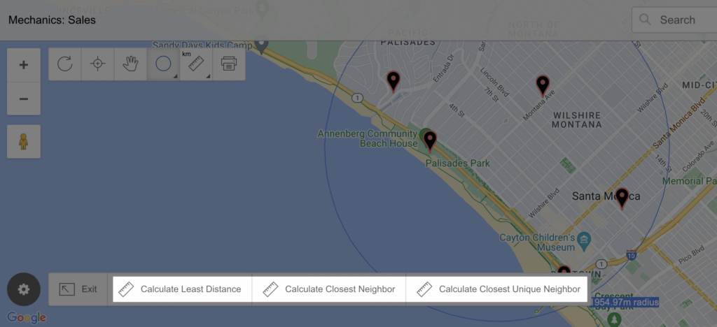
Calculate Least Distance goes through each point and finds its nearest point that hasn’t already been selected. You end up with pairs that are near each other. Odd numbers of points will leave one out.


Calculate Closest Neighbor goes through each point and finds its nearest point overall. There will likely be duplicates, but you know each place’s nearest other place.


Finally, Calculate Closest Unique Neighbor goes through each point and finds its nearest point. If there’s a duplicate, it favors the closest. In the end, you have the closest distances that don’t repeat any locations.


Note that each of these options will add a new column to the “Data View” of your map, displaying the distance between each of the points involved.

Though Match Closest Pairs covers the most common use cases, there are still other ways you can calculate distances.
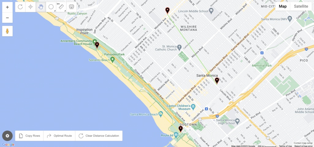
Match New Selection

There’s a second distance calculation choice when you’ve selected your points: Match New Selection. This option brings up the same sub-prompts as Match Closest Pairs.

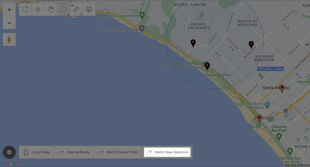
However, instead of only selecting an initial group of points, when you’re using Match New Selection, you’ll select a second group to compare to the first.

How to Match New Selection:

  1. Select your first group
  2. Click Match New Selection
  3. Select a second group
  4. Choose one of the three options (Calculate Least Distance, Calculate Closest Neighbor, Calculate Closest Unique Neighbor).

Without a second group of points, you won’t be able to select one of the sub-prompts, as you can see here:

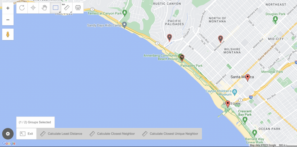
Once you’ve selected a second group, you’ll see the familiar prompts from which you can choose (i.e. Calculate Least Distance)

While the options work the same, Match New Selection always looks to connect each point in the first group with a point in the second group.

These two methods of matching locations with distances can help you make sense of many points at once. The final distance calculation method is useful when you’re looking for answers about a smaller number of points.
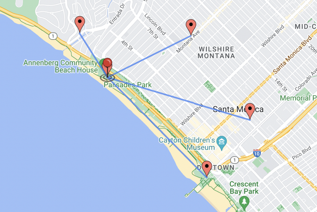
Marker Measure Tool

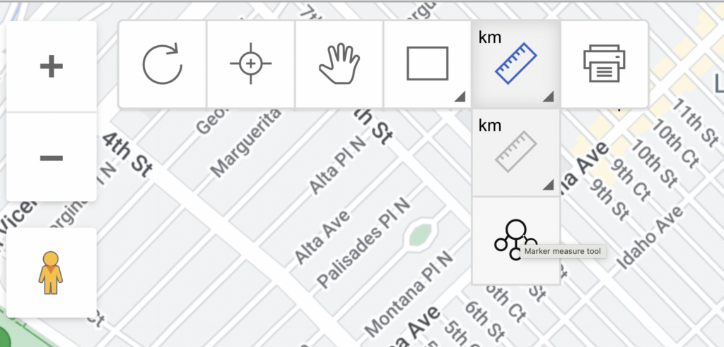
The Marker Measure Tool is another Advanced Mode feature, though it lives in the upper left-hand corner of your map under Measuring tools.

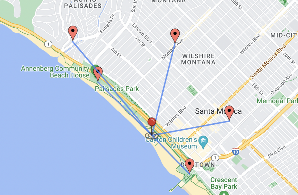
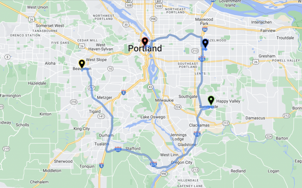
There’s no pre-selection needed with this tool. Just click it and then drag the pin on top of the location, which could be a current marker on your map or not, you want to know the distance of from the rest of your points.

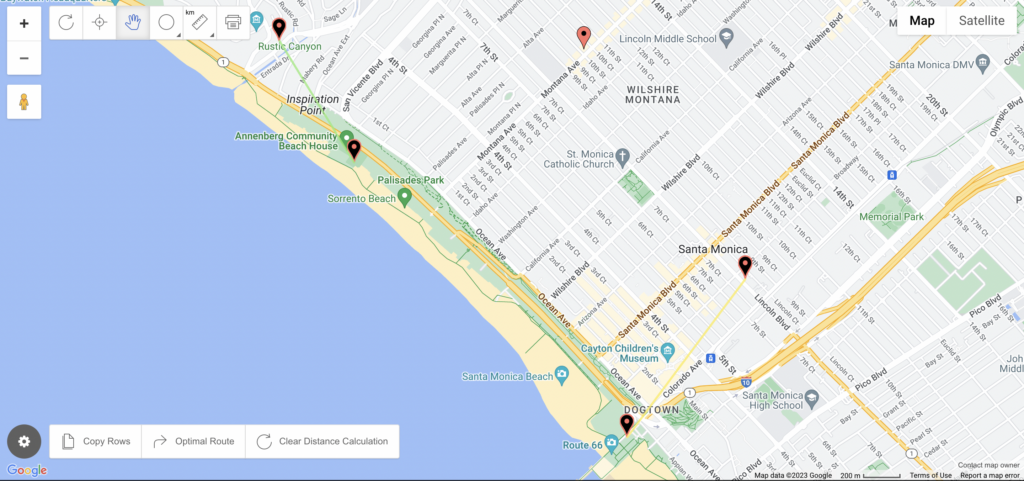
Map Your Data to Determine Distance

View Mechanics: Sales in a full screen map

You can calculate distances in completely customizable ways—all when you follow the steps to map your data with our tool.

  1. Open your spreadsheet
  2. Select (Ctrl+A or Cmd+A) and copy (Ctrl+C or Cmd+C) your data
  3. Open your web browser and navigate to batchgeo.com
  4. Click on the location data box with the example data in it, then paste (Ctrl+V or Cmd+V) your own data
  5. Check to make sure you have the proper location data columns available by clicking “Set Options”
  6. Click “Map Your Data” and you’re done!

Start calculating the distance between your points today at batchgeo.com.

Map Your Optimal Route to Custom Locations

Maps in these modern times have become more than just the thing you keep in your glovebox for emergencies. They’re part of daily life on our phones, in our cars, and embedded in websites. Routes between places is a common use case for Google Maps and similar directional tools. However, it’s not possible to load all your customers, for example, into a single Google Map without a bunch of code. Nor can you easily import today’s deliveries and jump in the car—not without a lot of manual address typing.

BatchGeo’s custom maps take your spreadsheet data and transform them into visual representations that can be filtered and browsed in multiple ways. In this post, we’ll show how BatchGeo Pro enables route optimization with up to 25 locations. This all starts with gathering the data for your map.

Determine the Stops for Your Route

Before you can optimally map your route… you’ll need to figure out where you need to go. You likely already have these locations in a spreadsheet, such as Excel, Google Sheets, or a similar system. For example, perhaps you have a sales CRM or other customer database. Simply export into a CSV or other spreadsheet format:

Be sure to separate each piece of data into individual columns and include headers. For example, for a sales trip, you might have:

  • Business
  • Business contact
  • Total sales
  • Address
  • City
  • State

Each business location represents a stop on your route. It’s fine if your map has more than the stops you want to route—you’ll have a chance to select the locations before routing. But first, let’s map your data.

Make a Map of Your Stops

View Sales Route in a full screen map

There are a bunch of ways to make a map: ArcGIS and other desktop GIS software, Google Maps API, along with web-based mapping tools. Our Excel mapping tool can copy-paste directly from your spreadsheets.

  1. In your spreadsheet, select (Ctrl+A or Cmd+A) and copy (Ctrl+C or Cmd+C) your data
  2. Open your web browser and navigate to batchgeo.com
  3. Click on the location data box with the example data in it, then paste (Ctrl+V or Cmd+V) your own data
  4. Check to make sure you have the proper location data columns available by clicking “Set Options”
  5. Click “Map Your Data” and watch as the geocoder turns your location data into coordinates

The resulting map is customizable, allowing you to adjust your map marker color, shape, map style, and more.

Create a map of a single day’s visits or go ahead and put all your customers on a single map. It’s possible through our map data visualization you’ll see new stories within your customer base. But first, let’s plan your customer or prospect visits and optimally map the route between two or more markers.

Optimally Map Your Route Between Points

Depending on your data, there may be times when you have two (or more!) points near each other. You might then wonder about the best way to navigate between them. So let’s take a look at the best way to get from Point A to Point B.

Upon right-clicking your map, BatchGeo Pro users will see both a “Data View” option and that of “Advanced Mode.”

If you turn on “Data View”, press the ⇧ Shift key and select the locations you wish to map a route between from the table below your map.

Clicking on “Advanced Mode” will reveal more selection tools in the upper left-hand corner of your map (including a digital measuring tape. For route optimization, you’ll want to opt for the Rectangle selection tool (or one of the two other selection options: Circle selection tool or Polygon selection tool). Then, capture two or more points on the map using one of the selection tools.

For both methods, you’ll now want to click Optimal Route in the lower left-hand corner of your map.

Next, you’ll want to choose your starting and ending locations. You can either choose to “Use First Selected Waypoint” for the “Starting Location” or manually enter any other location, regardless of whether it’s already a marker on your map. The same goes for your “Ending Location.”

Finally, click Map Optimal Route.

The result is a visual depiction of the best route between two points, plus the ability to hit the Navigate button to be taken to Google Maps directions.

Discover the optimal routes between your own data at batchgeo.com.

BatchGeo Ranks #1 in Satisfaction and Popularity from G2’s GIS Software Awards

Thousands of other map-makers endorsed your choice of an easy, customized map tool. BatchGeo is highly-ranked in G2’s Annual Best Software Awards. The listing ranks the world’s best software companies and products based on reviews from real users. BatchGeo was a 2022 winner and customers have again provided the feedback to get us on the 2023 list of best Geographic Information System (GIS) software.

Not only did BatchGeo score in the top three of GIS software—we’re also the #1 highest performer in some of the most important categories, satisfaction and popularity.

Check out the best-ranked GIS software for yourself, or continue reading for an in-depth look at the rankings along with a demonstration of our winning software.

G2’s GIS Highest Performer in Satisfaction is BatchGeo

Many factors go into G2’s rankings. BatchGeo users helped it climb to the top of many of the categories. BatchGeo ranks #1 in popularity, but even more satisfying is also being #1 in satisfaction. That points to happy users who can quickly convert data into interactive maps.

You can see how BatchGeo ranks in this category or note its place to the far right in G2’s top GIS Software Grid.

Most gratifying is that the satisfaction rankings are based on reviews, in which real users reported that BatchGeo is:

Excellent for a quick graphical analysis, with the ability for more in-depth analysis.

Another user said:

I have been using this product for a few years now. I like that it’s easy to copy and paste data from an Excel sheet and I like the color coded map… It is very easy to use and intuitive.

With over 1,000 reviews that average 4.7 out of 5 stars, BatchGeo is the best-reviewed and most-reviewed of the bunch.

BatchGeo Scores Among G2’s Top GIS Software Overall

GIS is a broad category, which includes downloadable desktop software and tools that programmers use to create maps with code. BatchGeo achieves the highest satisfaction and popularity, and is listed among some huge players in the overall rankings, called the G2 Score.

Of the 261 GIS companies and products ranked, the G2 Score winners were:

  1. Esri ArcGIS
  2. Google Earth Pro
  3. BatchGeo
  4. Google Maps API
  5. ArcGIS Online

BatchGeo is the only product in the top five that creates maps from spreadsheets and allows grouping and filtering based on your own data. In addition, BatchGeo outranks GIS software giants like Google Maps API and ArcGIS Online, plus 256 other tools.

G2 Score is a proprietary ranking algorithm, which takes into account many factors within real user reviews. The site also provides other sorting methods and scores. To be listed so high overall, BatchGeo performs well in many of these areas:

If you haven’t already given BatchGeo a try yourself, read on to walk through an example of how quickly you can map your own spreadsheet data.

G2’s GIS Satisfaction Winner HQs: Mapped

It’s an honor that BatchGeo customers ranked our mapping tool highly in so many categories. As we mentioned earlier, the satisfaction list is especially laudable, because it means BatchGeo users are happy with their experience. So, let’s take the data behind the top 20 G2 Satisfaction winners and map their company headquarters to show what’s possible with BatchGeo:

View G2’s GIS Satisfaction Winner HQs in a full screen map

All you need to make a custom map like the one above is some data and knowledge of copy and paste—no code required.

Here’s how we made it:

Whether your preferred platform is Excel, Google Sheets, or another option, start with a spreadsheet. We added the GIS companies that G2 ranked in the top 20 for Satisfaction with separate columns for each piece of information. Most important are columns for city, state, and country—or other location data.

From there, simply:

  1. Select (Ctrl+A or Cmd+A) and copy (Ctrl+C or Cmd+C) your data
  2. Open your web browser and navigate to batchgeo.com
  3. Click on the location data box with the example data in it, then paste (Ctrl+V or Cmd+V) your own data
  4. Check to make sure you have the proper location data columns available by clicking “Validate and Set Options”
  5. Select the proper location column from each drop-down
  6. Click “Make Map” and watch as the geocoder performs its process

Once mapped, trends you may have otherwise missed in “spreadsheet mode” become clearer. For example, we can see that of the top 20 GIS companies in Satisfaction, 13 are based in the U.S., including nine based in California, and two in Massachusetts.

Outside of the U.S., brands headquartered in the United Kingdom, Canada, France, India, Singapore, and Sweden also made it in the top 20 GIS companies.

There are plenty of insights waiting inside your own spreadsheets. Use our award-winning software to map your own data for free.