Map Your Optimal Route to Custom Locations
Maps in these modern times have become more than just the thing you keep in your glovebox for emergencies. They’re part of daily life on our phones, in our cars, and embedded in websites. Routes between places is a common use case for Google Maps and similar directional tools. However, it’s not possible to load all your customers, for example, into a single Google Map without a bunch of code. Nor can you easily import today’s deliveries and jump in the car—not without a lot of manual address typing.

BatchGeo’s custom maps take your spreadsheet data and transform them into visual representations that can be filtered and browsed in multiple ways. In this post, we’ll show how BatchGeo Pro enables route optimization with up to 25 locations. This all starts with gathering the data for your map.
Determine the Stops for Your Route
Before you can optimally map your route… you’ll need to figure out where you need to go. You likely already have these locations in a spreadsheet, such as Excel, Google Sheets, or a similar system. For example, perhaps you have a sales CRM or other customer database. Simply export into a CSV or other spreadsheet format:
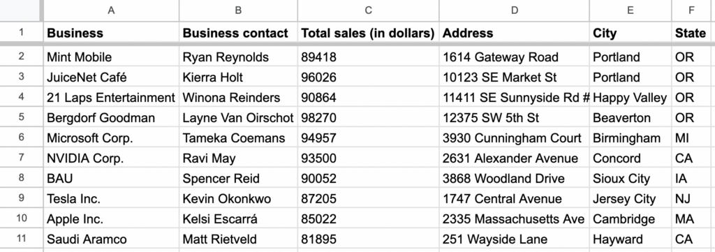
Be sure to separate each piece of data into individual columns and include headers. For example, for a sales trip, you might have:
- Business
- Business contact
- Total sales
- Address
- City
- State
Each business location represents a stop on your route. It’s fine if your map has more than the stops you want to route—you’ll have a chance to select the locations before routing. But first, let’s map your data.
Make a Map of Your Stops
View Sales Route in a full screen map
There are a bunch of ways to make a map: ArcGIS and other desktop GIS software, Google Maps API, along with web-based mapping tools. Our Excel mapping tool can copy-paste directly from your spreadsheets.
- In your spreadsheet, select (Ctrl+A or Cmd+A) and copy (Ctrl+C or Cmd+C) your data
- Open your web browser and navigate to batchgeo.com
- Click on the location data box with the example data in it, then paste (Ctrl+V or Cmd+V) your own data
- Check to make sure you have the proper location data columns available by clicking “Set Options”
- Click “Map Your Data” and watch as the geocoder turns your location data into coordinates
Interactive Maps Made Easy
Sign Up NowThe resulting map is customizable, allowing you to adjust your map marker color, shape, map style, and more.
Create a map of a single day’s visits or go ahead and put all your customers on a single map. It’s possible through our map data visualization you’ll see new stories within your customer base. But first, let’s plan your customer or prospect visits and optimally map the route between two or more markers.
Optimally Map Your Route Between Points
Depending on your data, there may be times when you have two (or more!) points near each other. You might then wonder about the best way to navigate between them. So let’s take a look at the best way to get from Point A to Point B.
Upon right-clicking your map, BatchGeo Pro users will see both a “Data View” option and that of “Advanced Mode.”
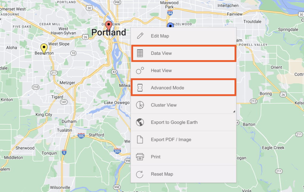
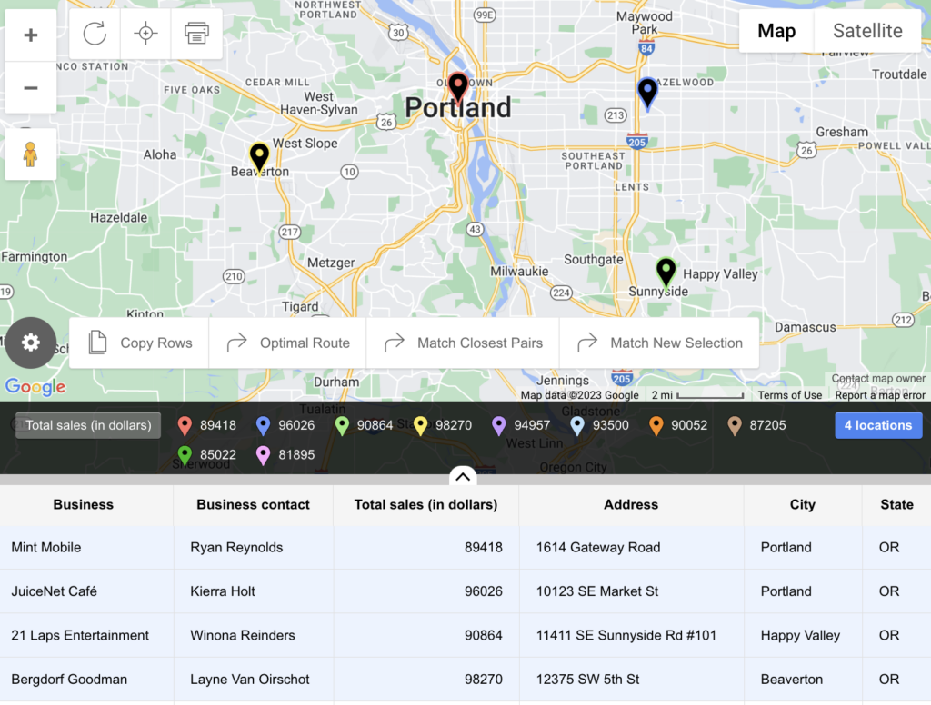
If you turn on “Data View”, press the ⇧ Shift key and select the locations you wish to map a route between from the table below your map.
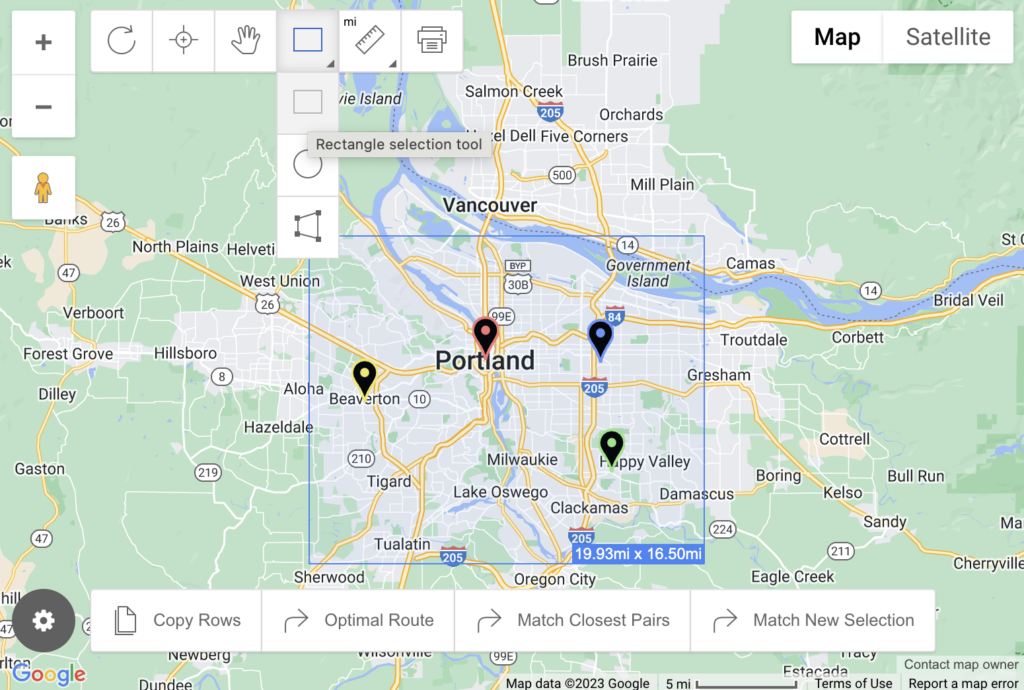
Clicking on “Advanced Mode” will reveal more selection tools in the upper left-hand corner of your map (including a digital measuring tape. For route optimization, you’ll want to opt for the Rectangle selection tool (or one of the two other selection options: Circle selection tool or Polygon selection tool). Then, capture two or more points on the map using one of the selection tools.
For both methods, you’ll now want to click Optimal Route in the lower left-hand corner of your map.
Next, you’ll want to choose your starting and ending locations. You can either choose to “Use First Selected Waypoint” for the “Starting Location” or manually enter any other location, regardless of whether it’s already a marker on your map. The same goes for your “Ending Location.”
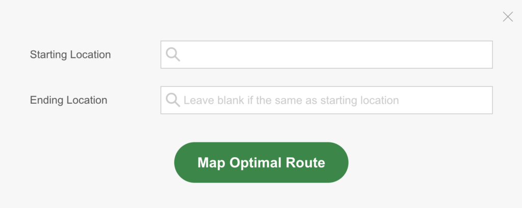
Finally, click Map Optimal Route.
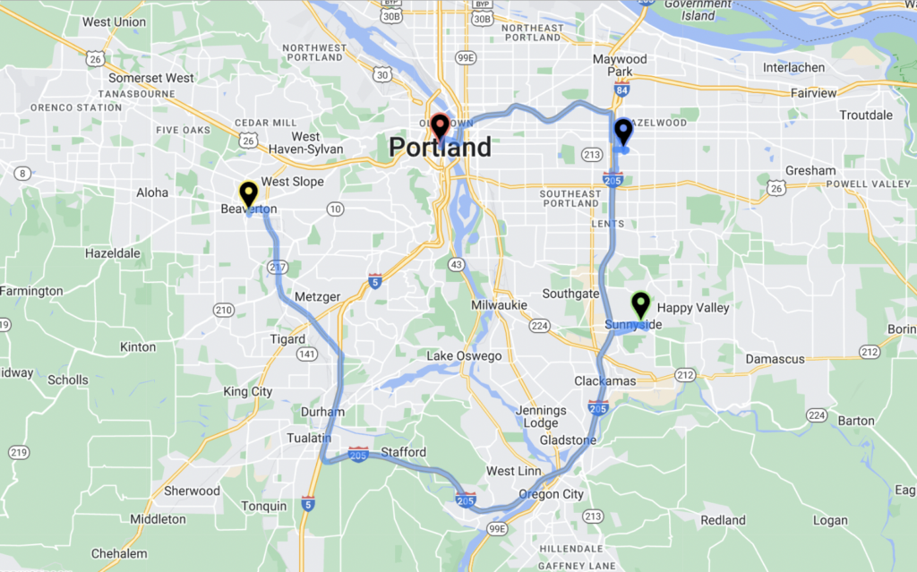
The result is a visual depiction of the best route between two points, plus the ability to hit the Navigate button to be taken to Google Maps directions.
Discover the optimal routes between your own data at batchgeo.com.
