Search Your Google Map by Locations and Coordinates
How many people can easily pinpoint where Nauru—one of the smallest island countries—is located in the Pacific Ocean? Or identify the exact location of 37.819722,-122.478611 on a map? Although you can zoom in and out of most online maps to aid your search for specific map markers, this doesn’t always enable everyone to find what they need quickly.
It’s easy to use Google Maps to find individual or multiple locations. What’s harder is identifying that single location without wiping out the rest of your search. One solution to this geographic puzzle is to build a map based on your own data, then add the data to Google. It’s too hard for most of us to do manually, but a free BatchGeo map can be generated from a spreadsheet.
So if you find yourself scouring a map for specific locations or coordinates, create a BatchGeo map and use the Search bar on any BatchGeo map, which is built on top of Google Maps. In this post, we’ll show multiple ways to search your map and how you get more information than just a pin’s location.
Find a City, State, or Country
Let’s start with a basic search.
View Example Sales Data in a full screen map
Say you have a sales map that includes customer cities and you’re looking for Buffalo Grove, Illinois customers…but where is that?
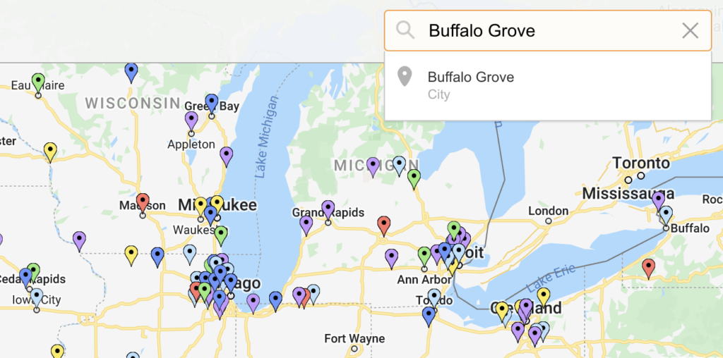
Instead of zooming in and out of Illinois to try and spot it, we’ll search for Buffalo Grove in the upper right-hand corner of the map.
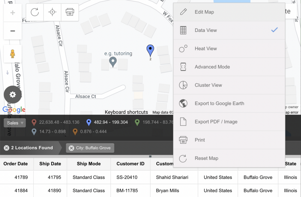
Click on the Search result and you can go directly to the map marker for Buffalo Grove. With our Data View, you’ll also see a list of all of the customers in Buffalo Grove under the map, along with any additional information from your spreadsheet of data.
Multiple Location Search Results
If there are multiple results of your Search (as is the case for the most common U.S. city names), you’ll see them all listed in Data View as well as on the map.
Interactive Maps Made Easy
Sign Up Now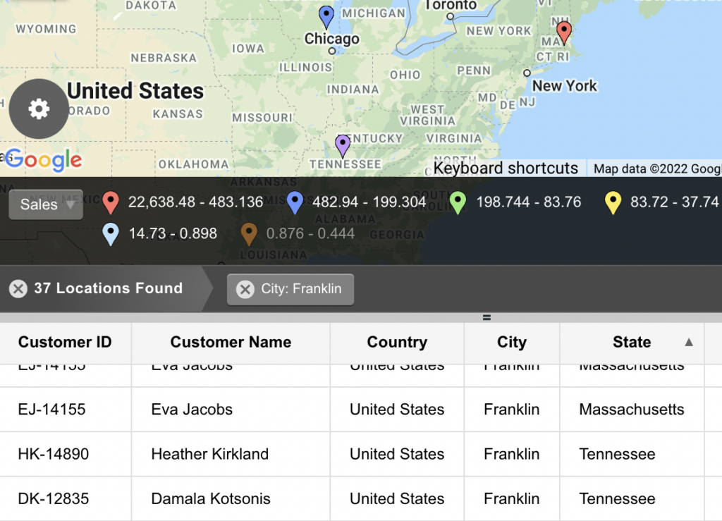
Of course, your ability to Search applies to more than just sales maps—and it’s also not just cities like Buffalo Grove or Franklin. Let’s see how latitude longitude searches work, even if the exact latitude and longitude aren’t data points on your map.
Latitude Longitude Searches (Exact and Nearest)
Moving on, you can also find a point on the map with a Search for a coordinate pair: latitude and longitude. Latitude and longitude are commonly depicted in decimal degrees (59.3277778, 18.09111111), with latitude typically listed first, followed by longitude.
Pinpoint Exact Latitude and Longitude
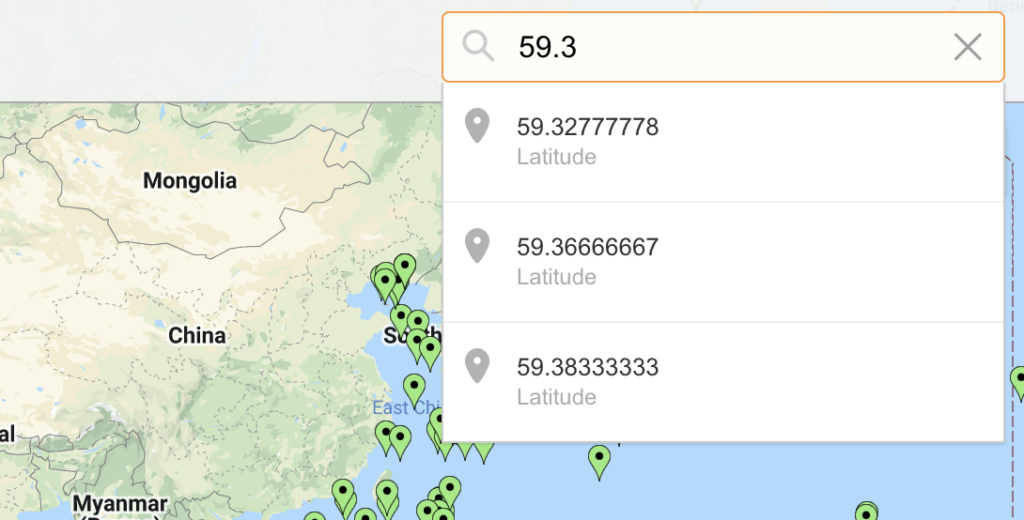
Of course, as with searching for a city, you can type in an individual latitude or longitude decimal. Let’s test it out with our map of 569 international shipwrecks.
View International Shipwrecks in a full screen map
It will appear as a Search result.
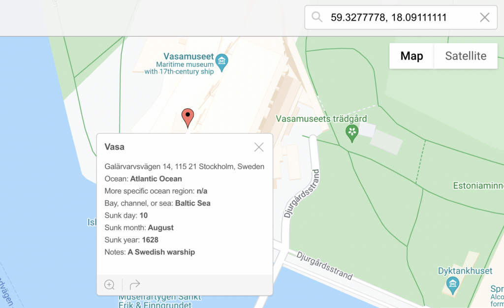
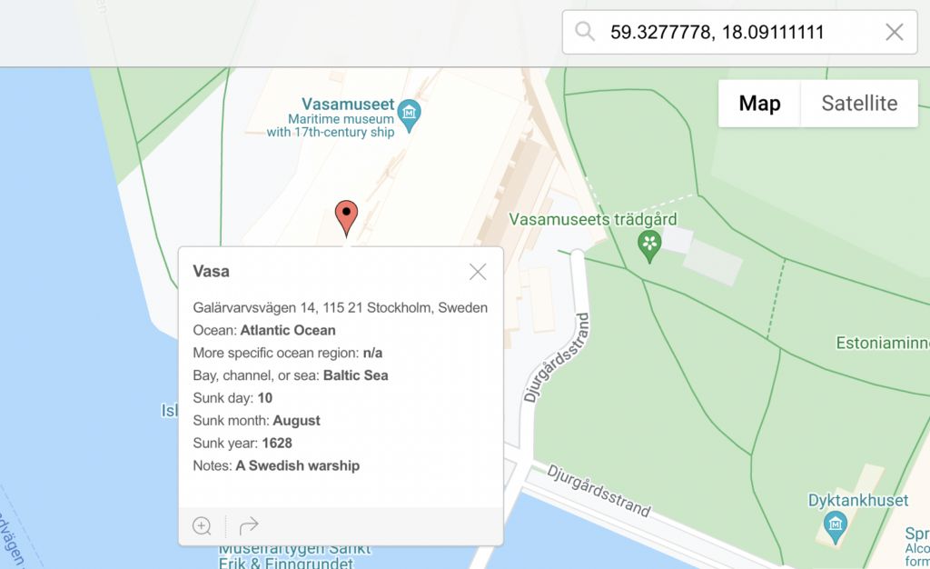
On the other hand, entering an entire coordinate pair will give you one of two results. If it’s a point pinned on your map, you’ll be taken directly to it. For example, a Search for the coordinates of the Vasa shipwreck (59.3277778, 18.09111111) takes you directly to the map marker.
However, if it’s not a point, the result will be different.
Find the Nearest Coordinates
Oftentimes, the exact coordinate pair (or even city, state, or country!) might not be contained in a marker on your map. In that case, you’ll get the nearest pin to your Search.
Now let’s see if there’s a shipwreck using Portland, Oregon’s coordinates (hint: there’s not because it’s land).
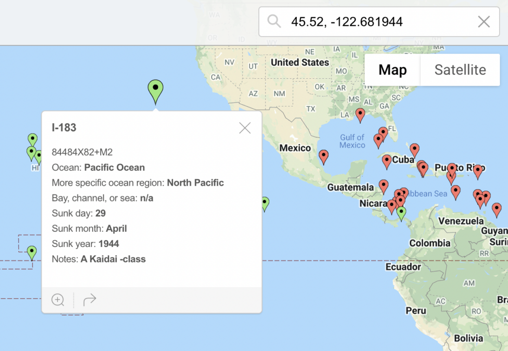
If you Search for a coordinate pair (or city, state, country, etc.) and it’s not a marker, you’ll get to see the nearest point to your Search. In this case, we’re taken to the I-183 wreck in the Pacific Ocean. While miles away from Portland, Oregon, the information is still useful—we know it’s the nearest marker on the map.
Getting the nearest pin to your Search also applies when searching for cities, states, countries, etc. Search for cities, states, countries, and geographic coordinates on any custom BatchGeo map you make from top golf courses to island countries.
