A Map of the Top Golf Courses & Where They’re Located
When the San Francisco 49ers transformed their football stadium into a 1,370-yard golf course one weekend back in 2017, fans—and even some of the 49ers’ players themselves—were eager to play.
Football may be America’s favorite pastime but golf—and even the courses it’s played on—are anything but forgettable. So let’s give a golf clap for the un-fore-gettable facts about the yardage and locations of these top golf courses that can be discovered on the map below.
View Golf Courses in a full screen map
We combined data from Golf Digest’s ranking of the 100 greatest American golf courses and Detroit Free Press’s table of PGA golf courses. You can sort the map by the yards, par, and points of these courses, or read on for more information.
Largest Top Courses
A football field spans 100 yards (or 120, including end zones). Yet some of these colossal courses are nearly 80 times that size. Let’s take a look at the 10 largest.
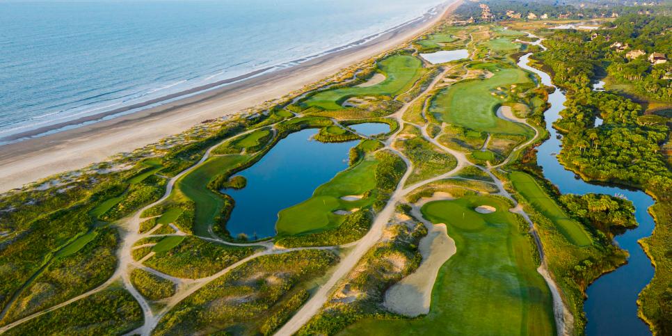
- Kiawah Island Golf Resort – Ocean Course (7,849 yards)
- The Gallery Golf Club At Dove Mountain (7,833)
- Whistling Straits (7,790)
- Erin Hills (7,731)
- Inverness Club (7,730)
- Congaree (7,725)
- Rich Harvest Farms (7,704)
- Castle Pines (7,701)
- Torrey Pines Municipal Golf Course – South Course (7,698)
- Hazeltine National Golf Club (7,678)
Not only is the Ocean Course at the Kiawah Island Golf Resort the #1 largest golf course in the U.S., but it was also the host of the 2021 PGA Championship. Together with Congaree, these two South Carolina courses comprise two of the 10 largest top golf courses in the country. And another two colossal courses are located in the Badger State of Wisconsin. Both Whistling Straits and Erin Hills add up to within 60 yards of each other and are around 70 miles apart.
Several states are home to just one massive course. This includes the Inverness Club in Ohio, Illinois’ Rich Harvest Farms, Castle Pines in Colorado, Arizona’s Gallery Golf Club At Dove Mountain, and the South Course at California’s Torrey Pines Municipal. But let’s look at some courses with other similarities.
Large Courses with the Same Yardages
In the previous section, we looked at top golf courses located in the same state. Now, let’s explore the courses that, while across the country from one another, have another similarity: their yardages.
Interactive Maps Made Easy
Sign Up NowMany courses on the map have a twin—at least when it comes to yardage. To view these pairs, sort the map by yards. More interesting are the courses of three, even four, with the exact same yardage, down to the tee.
The Sedgefield Country Club in North Carolina, TPC Harding Park in California, and Michigan’s Warwick Hills Golf Country Club are all located on 7,127-yard courses. And what do Diamond Creek, Double Eagle, and the Old Course at the Royal Troon have in common? The number 7,175. These course triplets are located in North Carolina, Ohio, and Scotland in the U.K., respectively.
The last three courses spanning identical yards include Calusa Pines in Florida, Virginia’s Kinloch, and the North Course at Silverado Resort & Spa in California.
Finally, these four golf courses are all 7,400 yards: the two South courses at Ontario’s Angus Glen and Ohio’s Firestone Country Club and, perhaps most interesting of all, New Jersey’s Lower Course at Baltusrol and Liberty National—also in the Garden State. How can we map a route between the two?
Optimally Map A Route
We mentioned the Baltusrol and Liberty National courses are located in New Jersey. These two 7,400-yard courses are just under 18 miles away from one another in Springfield and Jersey City, respectively. So let’s take a look at the best way to get from Point A (Baltusrol) to Point B (Liberty National).
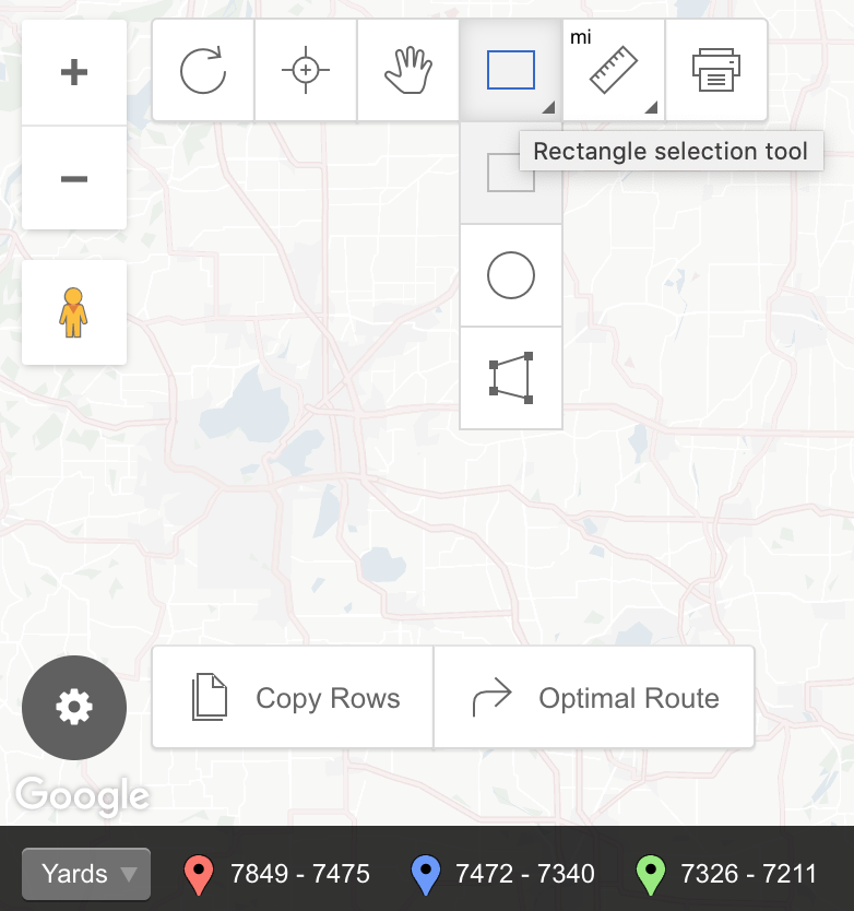
In Advanced Mode on your map, opt for the Rectangle selection tool (or one of the two other selection options: Circle selection tool or Polygon selection tool). Capture a point on the map and click on Optimal Route.
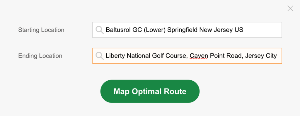
Then, type in a Starting Location (Baltusrol, in our case) and Ending Location and click the button to map. The result? A visual depiction of the best way between two points and the ability to hit the Navigate button to be directly taken to Google Maps directions. Get started mapping the Optimal Routes of your data at batchgeo.com.
