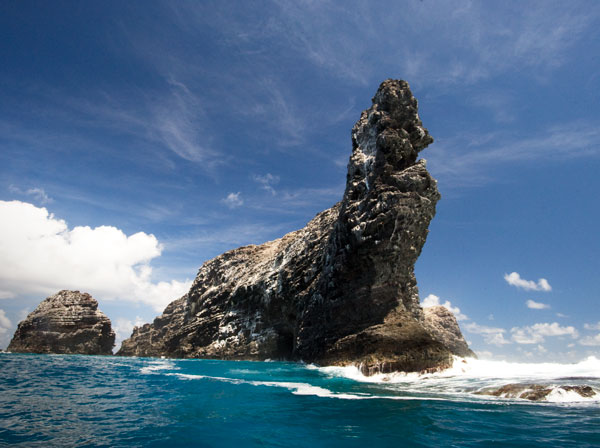
Marine Protected Areas, Mapped
Over 70% of our planet is covered by the ocean. The ecosystems living under the sea are immensely important for those of us above water, as they can help reduce the impacts of climate change and greenhouse gas emissions.
In order to protect the most important ecosystems, they’re classified as marine protected areas (MPAs), which restricts human activity such as fishing.
In the U.S., the nearly 1,000 marine protected areas make up around 26% of the surrounding waters, including the Great Lakes. Marine protected areas vary widely in size, year established, and design, as you’ll see on the map below.
View Marine Protected Areas in a full screen map
Largest Marine Protected Areas: Papahanaumokuakea & More
If you add up all of the 979 U.S. marine protected areas, they total over 1,573,511 square miles. Of course, the 10 largest on the table below make up almost 95% of that.
| Marine Protected Area Name | Area (square kilometers) |
|---|---|
| Papahanaumokuakea Marine National Monument | 1,515,720 |
| Pacific Remote Islands Marine National Monument | 1,277,860 |
| Papahanaumokuakea Marine National Monument Particularly Sensitive Sea Area | 363,687 |
| Marianas Trench Marine National Monument | 248,517 |
| Mariana Trench National Wildlife Refuge | 205,562 |
| Yukon Delta National Wildlife Refuge | 84,092 |
| Arctic National Wildlife Refuge | 79,933.1 |
| National Marine Sanctuary of American Samoa | 35,373.7 |
| Rose Atoll Marine National Monument | 35,004.6 |
| Alaska Maritime National Wildlife Refuge | 18,396.6 |
Established in 2006, Hawaii’s Papahanaumokuakea Marine National Monument is the largest marine protected area in the U.S. Named for the Hawaiian creator goddess Papahānaumoku and her husband Wākea, Papahanaumokuakea is home to around 7,000 species. Among these include many endangered animals, such as the hawksbill sea turtle and Hawaiian monk seal, among others.
Interactive Maps Made Easy
Sign Up NowThe monument and its surrounding waters span nearly 585,223 square miles—more than all of America’s state parks combined. It’s slightly larger than Australia’s Great Barrier Reef Marine Park, approximately the size of Germany.
Within the Papahanaumokuakea Marine National Monument is a 363,687 square kilometer Particularly Sensitive Sea Area, which is the third-largest MPA on the list above. This serves as an additional layer of protection for the important marine resource.
Moreso than this single large monument in Hawaii, the Pacific Remote Islands are home to four large marine protected areas. The largest of these (and the second-largest in the entire U.S.) is the Pacific Remote Islands Marine National Monument, which is nearly twice the size of Texas.
While the largest area for individual MPAs is interesting, you may have noticed something else on the map: some areas have considerably more MPAs than others.
The Most U.S. MPAs Are in Florida
Hawaii and the Pacific Remote Islands may be home to the largest marine protected areas, but are they where the most are located? The following list contains the U.S. states with more marine protected areas than any other.
- Florida – 216 marine protected areas
- California – 196
- Washington – 64
- North Carolina – 44
- Puerto Rico – 37
- Oregon – 32
- Hawaii – 30
- Virginia – 28
- New Jersey – 26
- New York – 25
Florida may not be the largest state nor the most populous. What the Sunshine State does have is the most marine protected areas in the country. Altogether, Florida’s MPAs are made up of 60 state parks, 35 aquatic preserves, and 27 wildlife management areas, among others.
The largest of Florida’s MPAs is the Florida Keys National Marine Sanctuary at 9901.11 square kilometers. The 6253.26 square-kilometer Everglades National Park is the second-biggest MPA in Florida.
Meanwhile, Florida’s oldest marine protected areas include Pelican Island National Wildlife Refuge (1903), which is also the oldest MPA out of the 979 in the U.S. Passage Key National Wildlife Refuge (1905) is the next oldest in FL, though another state’s national wildlife refuge is older, as we’ll see when we dive further into the age of these marine protected areas.
Oldest Year Established
As we mentioned, the first marine protected area in the U.S. was established in 1903 by President Theodore Roosevelt. The name of the 21.9905 square kilometer MPA, Pelican Island National Wildlife Refuge, comes from the Brown pelicans the refuge houses. Let’s look at the other oldest MPAs:
| Marine Protected Area Name | State | Year Established |
|---|---|---|
| Pelican Island National Wildlife Refuge | FL | 1903 |
| Breton National Wildlife Refuge | LA | 1904 |
| Passage Key National Wildlife Refuge | FL | 1905 |
| Huron National Wildlife Refuge | MI | 1905 |
| Shell Keys National Wildlife Refuge | LA | 1907 |
| Key West National Wildlife Refuge | FL | 1908 |
| Pine Island National Wildlife Refuge | FL | 1908 |
| Matlacha Pass National Wildlife Refuge | FL | 1908 |
| Island Bay National Wildlife Refuge | FL | 1908 |
| Robert Moses State Park – Long Island | NY | 1908 |
Joining Pelican Island among Florida’s oldest include previously discussed Passage Key National Wildlife Refuge, along with four more, all established in the same year.
Louisiana’s 113.803 square kilometer Breton National Wildlife Refuge was established in 1904, making it the second oldest, along with the much smaller Shell Keys National Wildlife Refuge (0.015896 square kilometers) in 1907. Notably, Huron National Wildlife Refuge is the first marine protected area in the Great Lakes.
Don’t forget to group the map by Design to see which of the 979 marine protected areas are national wildlife refuges, state parks, aquatic preserves, and more, along with Fishing Restrictions.
For more maps about ocean and land conservation, visit Endangered Animals on a Map.
