Mapping the Journey of Lewis & Clark
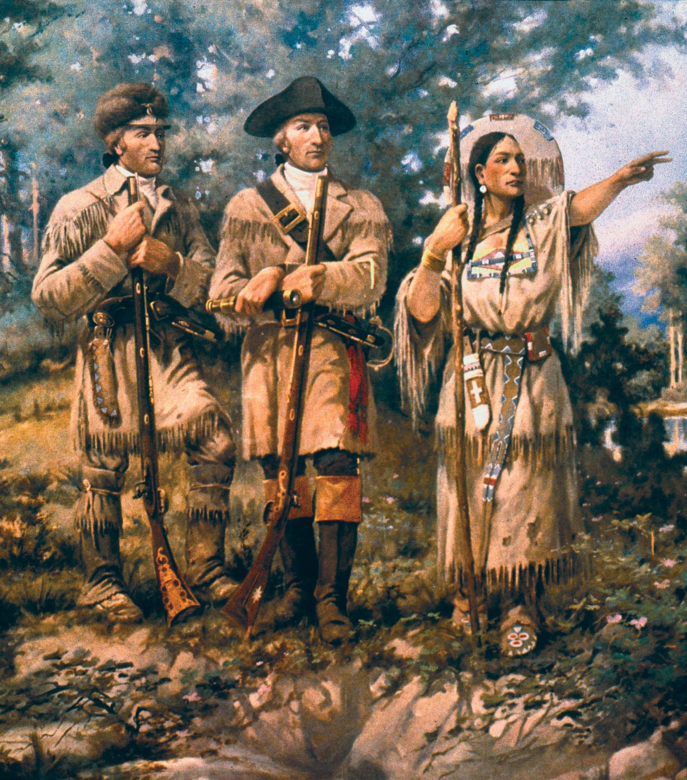
In May 1804, Meriwether Lewis and William Clark—along with Clark’s enslaved servant York and an assortment of expedition members—set out from St. Louis on a journey commissioned by President Thomas Jefferson. Known as the Corps of Discovery, their mission was to explore the newly acquired Louisiana Territory, map a route to the Pacific Ocean, and establish trade and diplomatic relations with Indigenous nations along the way. Mapping their journey today shows just how ambitious this mission was.
Over the course of more than two years, the expedition traveled thousands of miles by river, horse, and foot. Along the way, they documented landscapes, plants, and animals previously unknown to American science. They also recorded the challenges of terrain and weather while relying heavily on the knowledge and assistance of Native peoples, including Sacagawea, whose guidance and interpretation were vital to the expedition’s progress.
A Map of the Expedition
Visualizing Lewis & Clark’s journey on a map highlights just how vast and varied the expedition was. The route stretched across plains, rivers, and mountain ranges before finally reaching the Pacific coast.
View Notable Lewis & Clark Exploration Stops in a full screen map
The map above shows known significant stopping points along the way as noted by the National Park Service. Select any marker to see the name and location of a camp, fort, or landmark tied to the expedition.
Following the Trail
Breaking down the journey into segments shows the incredible range of landscapes and experiences.
The Departure (Spring of 1804)
Leaving the last comforts of American towns behind, the Corps of Discovery embarked on their mission up the Missouri River. What lay ahead was largely unmapped by the United States, and preparations reflected both ambition and uncertainty.
Camp Dubois (Illinois)
This spot, just across from where the Mississippi and Missouri Rivers meet, is where the Corps spent the winter of 1803–1804 drilling, gathering supplies, and training for the journey. Also known as Camp River Dubois, it served as the expedition’s launch point.
Interactive Maps Made Easy
Sign Up Now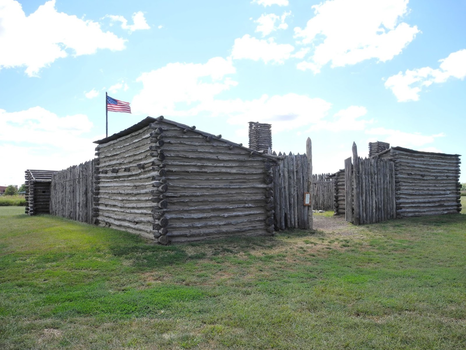
St. Charles, Missouri
On May 21, 1804, Lewis and Clark departed from this riverside settlement to the cheers of townspeople. St. Charles was their last stop in US territory before heading into land the country barely knew or controlled.
Up the Missouri (Summer of 1804)
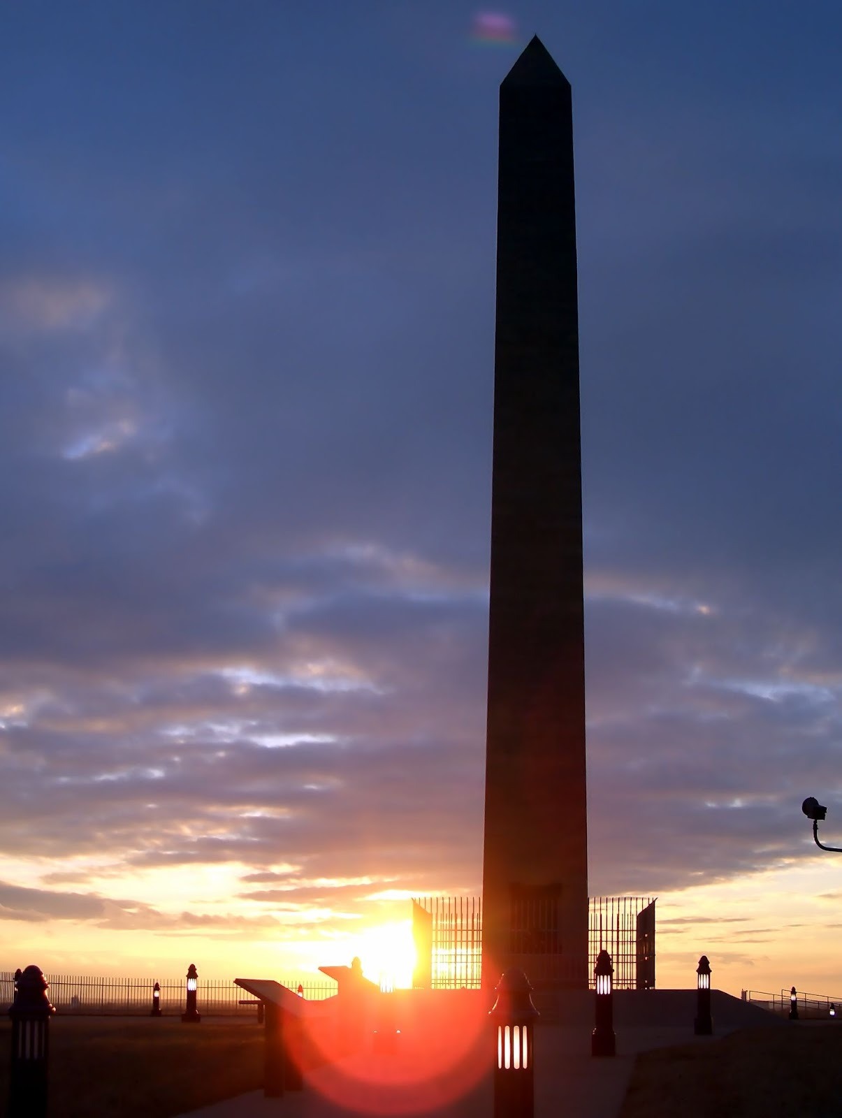
Sergeant Floyd Monument (Iowa)
Charles Floyd, the only member of the Corps to die during the journey, succumbed to illness near present-day Sioux City. His burial mound and the tall white obelisk erected later mark the somber moment when the group realized their own vulnerability.
Spirit Mound (South Dakota)
Guided by local Indigenous accounts, Lewis and Clark hiked to this prairie rise, described as inhabited by “little people.” The Corps’ detailed observations of Spirit Mound reflect their curiosity, as well as their respect for Indigenous traditions.
Winter on the Plains (1804–1805)
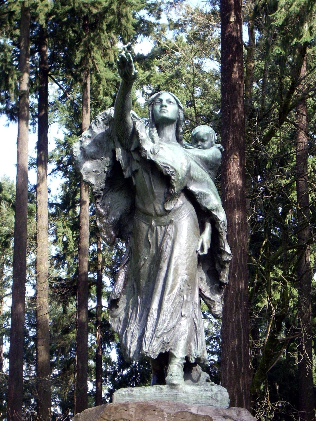
As winter set in, the expedition built shelter near the Mandan and Hidatsa villages in present-day North Dakota. Here they gained the support of Sacagawea, whose help became vital to their journey.
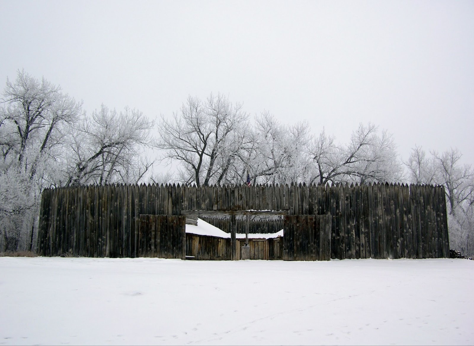
Fort Mandan (North Dakota)
The Corps built this fort along the banks of Missouri, building cabins to withstand bitter cold while forging relationships with local tribes. It was here that Sacagawea and Toussaint Charbonneau joined the expedition, an addition that would shape the journey ahead.
Knife River Indian Villages (North Dakota)
These earthlodge villages were thriving centers of trade long before the expedition. Lewis and Clark described bustling communities, agricultural practices, and networks that extended far beyond the Missouri Valley.
Across the Plains and Mountains (Summer 1805)
By the summer of 1805, the wide prairies gave way to dramatic geological challenges. Rapids, waterfalls, and the looming barrier of the Rockies tested the Corps’ endurance.
Great Falls of the Missouri (Montana)
Instead of a single waterfall, Lewis and Clark found a series of five—forcing a grueling portage across miles of rough terrain. The ordeal took over a month, demonstrating the expedition’s resilience in the face of natural obstacles.
Lemhi Pass (Montana/Idaho)
Crossing the Continental Divide, Lewis reached Lemhi Pass in August 1805. His journal entry captures the significance of this moment: the first sight of waters flowing toward the Pacific, and the daunting realization of more mountains ahead.
To the Pacific (Autumn 1805–Winter 1806)
The Corps followed swift rivers into the Columbia Basin, where storms, hunger, and uncertainty clouded their approach to the ocean. At last, they reached the edge of the Pacific, the world they had long sought.
Dismal Nitch (Washington)
Trapped by violent storms near the mouth of the Columbia river, the Corps huddled for days in wet misery. Their journals speak of soaked clothing, spoiled supplies, and the fear that they might not survive to see the ocean.
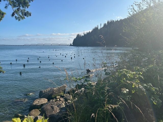
Fort Clatsop (Oregon)
Once they reached the coast, the expedition built winter quarters near present-day Astoria. From December 1805 to March 1806, they endured months of rain while recording detailed observations of the coastal environment.
The Return (1806)
With their mission accomplished, Lewis and Clark divided the Corps to explore more terrain on their return. Their final months included both triumph and tragedy, as they carved their mark on the land and encountered conflict.
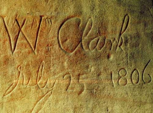
Pompeys Pillar (Montana)
On July 25, 1806, Clark carved his name into a sandstone pillar along the Yellowstone River—a mark that still stands today as the only remaining visible trace of the expedition on the landscape.
Camp Disappointment (Montana)
Lewis pushed north to this camp in hopes of proving U.S. claims to more territory. The effort brought only frustration, and soon after he faced a violent clash with Blackfeet warriors that highlighted the dangers of the return journey.
Interested in another great journey across the American West? Check out our article on Oregon Trail sites.
Create Your Own Map
Your journey may not be across a continent, but mapping it could still reveal surprises. Whether it’s customer addresses, business locations, or your favorite coffee shops, a map brings data to life.
BatchGeo is the fastest way to create your own custom map. It’s free to try, with sample data included to get you started. Try it today and see where your data takes you.
