A Map Of Cities Straddling The Equator
The equator, an imaginary line circling the Earth at 0 degrees latitude and divides the planet into the Northern and Southern Hemispheres, plays a crucial role in shaping global climate and geography. Latitude, which measures distance from the equator, influences everything from temperature to weather patterns, creating distinct environments across different regions. Cities near the equator experience year-round warmth, lush landscapes, and unique ecosystems, making them hubs of biodiversity and cultural vibrancy.
In this article, we’ll define “near the equator” as being within 15 degrees latitude north or south. Cities in this region tend to have warm weather year-round, with fewer seasonal changes, thanks to the sun’s consistently direct angle. The sun’s angle means these cities also experience less variability in the number of daylight hours throughout the year.
View Cities Near the Equator by Latitude / Longitude in a full screen map
Click on any marker on the map to see more information. You’ll find the specific city name, country, and the latitude and longitude. You can also check out our map of cities around the world.
What are Some Cities Near the Equator?
Pontianak, Indonesia
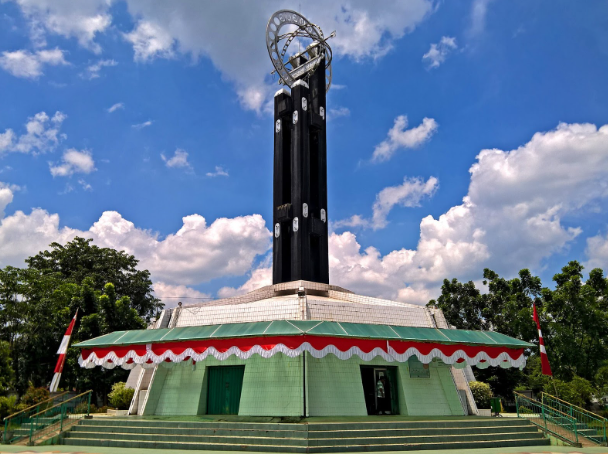
At a latitude of 0°01, Pontianak, Indonesia is the city closest to the equator in the world. Found in the West Kalimantan province on the island of Borneo, this unique city is famously bisected by the equator, earning it the nickname “Kota Khatulistiwa” or “Equator City.” Visitors can stand on the exact line at the Equator Monument, where the sun casts no shadow during the equinox. Beyond its geographical claim to fame, Pontianak is a bustling riverside city rich in culture, influenced by Malay, Dayak, and Chinese heritage.
Darwin, Australia
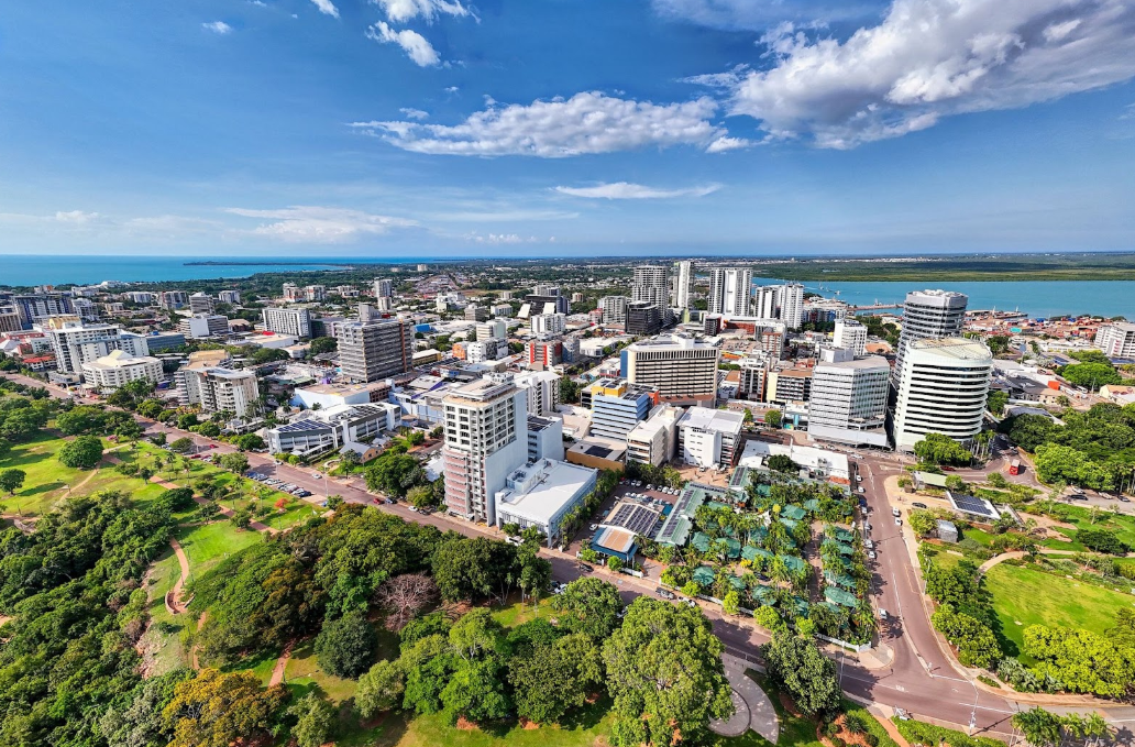
Named after Charles Darwin by European sailors after their former and now famous passenger, Australia’s northernmost capital city is found at latitude of 12°27′S and is a vibrant gateway to the tropics. Found on the Timor Sea in the Northern Territory, Darwin is known for its warm, humid climate, stunning sunsets, and laid-back outdoor lifestyle. Its proximity to Southeast Asia has shaped a diverse cultural scene, with influences from Aboriginal, Asian, and European traditions.
Interactive Maps Made Easy
Sign Up NowLagos, Nigeria
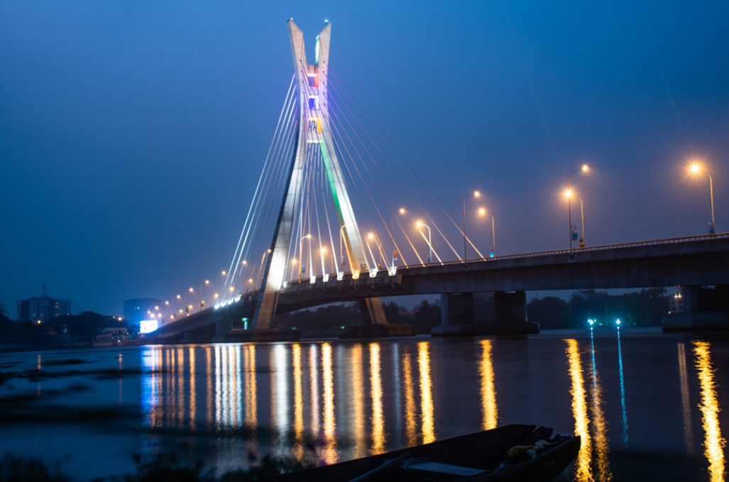
Found at latitude of 6°27’N, Lagos is Nigeria’s largest city and the most populous urban center in Africa. Set along the Gulf of Guinea, Lagos is a bustling economic powerhouse known for its energetic atmosphere, thriving entertainment industry, and expansive waterways. Its tropical climate, combined with a fast-growing skyline and vibrant street life, makes it a city constantly on the move. A cultural melting pot shaped by Yoruba traditions, colonial history, and international influences, Lagos is a place where music, commerce, and innovation drive its ever-evolving identity.
Lima, Peru
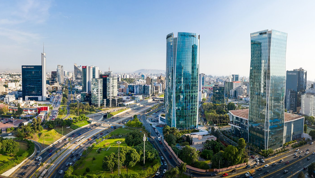
The bustling capital of Peru, and the country’s largest city is located at a latitude of 12°2’S. Known for its dramatic cliffs, colonial architecture, and world-renowned culinary scene, Lima blends history with modern vibrancy. Its warm desert climate, tempered by coastal breezes, makes it a city of year-round activity. With a cultural landscape shaped by Indigenous, Spanish, African, and Asian influences, Lima stands as a dynamic metropolis where tradition and innovation coexist.
Bengaluru, India
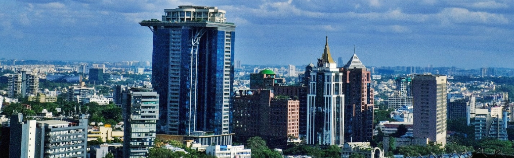
Bengaluru (formerly known as Bangalore) is India’s vibrant technology hub and one of its largest cities. Located at a latitude of 12°58’N, the city blends colonial-era architecture with modern skyscrapers. Despite its proximity to the equator, Bengaluru offers a mild year-round climate thanks to its elevation. First founded in 1537 by the local ruler Kempegowda, the city has evolved from a small fortified town into a global center for innovation and technology over the centuries.
Create Your Own Map
Do you have your own data sitting in a spreadsheet waiting to be talked about? It probably won’t be about cities, but even if its customer addresses, business locations, or a list of deliveries, maps can help tell the story of that data.
BatchGeo is your fastest way to make a custom map. If you’re not sure what data to try it with first, there’s even sample data to help you get started. Try it today for free!
