Cities Around the World by Latitude and Longitude
Every city in the world has one thing in common: they each have a pair of coordinates, numbers that describe their location. While no cities can share both sets of coordinates (since it’s the exact location of the city), many share one of the numbers that make up their coordinate pair.
These coordinates, called latitude and longitude, are used to create maps like the one below. In addition to the cities’ exact locations, we found their nearest latitude and longitude (within 5 degrees), and you can filter the map by these ranges.
View Cities by Latitude & Longitude in a full screen map
Read on to find out more about latitude/longitude coordinates, and see some surprising commonalities when we look at cities with the same latitudes or longitudes.
What are Latitude and Longitude?

Before you can interpret the map above, you need to know about the pair of numbers used to plot map coordinates: latitude and longitude.
Latitude is the number of degrees north or south of the equator, the imaginary line that runs horizontally through the Earth.
Longitude is the number of degrees east or west of the prime meridian, an even more imaginary line because it was made up.
Stand up and imagine your feet represent an exact point on Earth. Do you know which way North is? Use one arm to point precisely North and position your other arm in the exact opposite direction. The line your pointing makes would be the longitudinal line for your location. Now move your arms to point East and West. The line formed by your arms is the latitudinal line for your location.
While latitude is determined by the equator, humans had to make up a midpoint for longitude. In 1851, Sir George Airy chose the observatory in Greenwich, England, an area of London, to be zero longitude. Thirty years later, 25 nations met to officially declare it the prime meridian.

Every point on Earth can be described by a number of degrees latitude and a number of degrees longitude. Like an algebraic plot, each number can be positive or negative. In other words, we’ve taken a circular Earth and separated it into quadrants. The mid-point of these quadrants is 0 degrees latitude (the equator) and 0 degrees longitude (the North-South line that runs through Greenwich Observatory).
Interactive Maps Made Easy
Sign Up NowLatitude increases as you go North, making the Northern Hemisphere positive latitude and the Southern Hemisphere negative latitude. Paris, for example, is at about 48, 2. Latitude usually comes first in the pairing. Latitude runs between 90 degrees South (-90) and 90 degrees North, both extremes coming at the Earth’s poles.
Longitude increases as you go East, making Eastern Hemisphere (i.e., most of Europe) positive longitude and the Western Hemisphere negative longitude. New York, for example, is at about 40, -73. It’s North of the equator and West of the prime meridian. Longitude runs from 180 degrees West (-180) to 180 degrees East. Since longitude wraps around the Earth, -180 and 180 are the same line, on the opposite side from the prime meridian.
Using the map, can you find some cities in the southeastern hemisphere? Southwestern? Which “quadrant” do you live in?
Cities on the Equator and the Prime Meridian
While much of the worth is solidly within hemisphere quadrants, there are many cities that straddle one of the zero points. These cities, by definition, must be either along the equator or the prime meridian (i.e., have a similar longitude to London).
The map shows 22 cities that are within two and a half degrees of the equator. You can find them by using the grouping function in the lower left corner of the map. Choose “Near Latitude” and then choose the 5 to -10 range. Or, search the map for “0” and choose “0 (Near Latitude).”
Macapá, Brazil; Quito, Ecuador; Padang, Indonesia; Libreville, Gabon; Kampala, Uganda
To get even more specific, we narrowed down to 11 cities that are less than a degree away from Earth’s horizontal midpoint. The closest to the equator is Pontianak in Indonesia, whose city center is within one second (1/60th of a degree) of zero degrees latitude.
Here are all 11 of the places within a degree of the equator:
- Macapá, Brazil
- São Tomé, São Tomé and Príncipe
- Libreville, Gabon
- Entebbe, Uganda
- Kampala, Uganda
- Pekanbaru, Indonesia
- Quito, Ecuador
- Kismayo, Somalia
- Padang, Indonesia
- Pontianak, Indonesia
- Yaren District, Nauru
Since zero longitude is within densely populated Europe, there are more places that are close to this human-created coordinate. The closest, of course, is London—or Greenwich, specifically. There are 44 cities on the map that are closest to 0 longitude. Yet, there are only a dozen that are less than one degree from zero.
Greenwich, England; Accra, Ghana; Valencia, Spain; Bordeaux, France; Le Havre, France
Here are all 12 places within a degree of the prime meridian:
- Accra, Ghana
- Tamale, Ghana
- Zaragoza, Spain
- Valencia, Spain
- Lleida, Spain
- Bordeaux, France
- Brighton and Hove, England
- London, England
- Greenwich, England
- Le Havre, France
- Cambridge, England
- Peterborough, England
A much less populated place? The opposite of the prime meridian. At either 180 or -180 (it’s the same place), you’ll find just two places. One is far north and another in the south: Rabi Island, Fiji; Anadyr, Russia. Move the map around and see if you can find them!
Famous Cities and Their Coordinate Partners
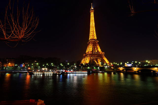
Ah, Paris. The City of Lights. A place for lovers. Yes, Paris seems like a magical place. Yet, it is on the same latitude as Seattle, a place best known for… rain. While Seattle is slightly rainier than Paris, it’s not by much. Similarly, London gets a bad rap and it’s only a few degrees north of Paris.

Surely New York City has a similar reality distortion field, causing it to appear better than other places of similar latitude? At 40 degrees North of the equator, the snowy-wintered New York is at a similar longitude to… Portugal, Spain, and the rest of the beautiful Mediterranean. To be fair, Sendai, Japan, is also around 40 degrees latitude, and it has nearly freezing temperatures in January.
Longitudinally, New York is around the same at 73 degrees West as most of the country of Chile. Interestingly, South America is almost entirely east of the United States. The time zones range from UTC -05:00 (same as Eastern time) to UTC -02:00.
Interactive Maps Made Easy
Sign Up Now
Speaking of South America, São Paulo, the largest city in the Southern Hemisphere, is 22 degrees South of the equator. That puts it similar to Johannesburg (the capital of South Africa) and Brisbane (the third-largest city in Australia). On the longitude scale, much of Brazil has no countries North or South of it. Seriously, check the map! The only non-Brazilian place at 50 degrees West is the tiny and remote Qaqortoq, Greenland.
The Far North and South
Locations in the North and South are best known for their extremes. The poles are each covered in snow year round, so expect cold temperatures in these cities to the far North and South.
The Northernmost city in the world is Alert, Nunavut, Canada, at more than 82 degrees North. That puts Alert just 550 miles (885 km) from the North Pole. In Europe, Norway’s Ny-Ålesund is over 78 degrees above the equator. And Alaska is home to the northernmost U.S. city of Barrow, at 71 degrees latitude.
The Southernmost city in the world is Puerto Williams, Chile, and it’s nearly 10 degrees farther south than any other continent’s southern city. At 54 degrees below the equator, it may not seem as far south as you expect. However, Antarctica reaches out to about 60 degrees latitude, so there’s not much room for inhabited cities much closer.
Other far-Southern cities include Invercargill, New Zealand (46 degrees South) and Cape Town, South Africa (at -33 degrees latitude).
