BatchGeo Named Mapping Leader by Sourceforge

BatchGeo has been awarded a Spring 2024 Leader Award by SourceForge, the world’s largest software and services review and comparison website. This award recognizes exceptional companies and products with outstanding user reviews that put them in the top fifth percentile of highly reviewed products on SourceForge.
And the BatchGeo reviews are clear—it’s easily the best way to create maps.
Best-Rated Software for GIS and Sales Territory Mapping
SourceForge ratings are based on user reviews, relying on the wisdom of the crowd to choose the right winners. BatchGeo is a leader in two separate categories: best GIS software and top territory mapping solution. Not only is it well-reviewed, but every user would recommend it to others. It’s high praise, especially in the GIS category, which includes hundreds of other tools. Among them all, BatchGeo came out on top of the best mapping apps.
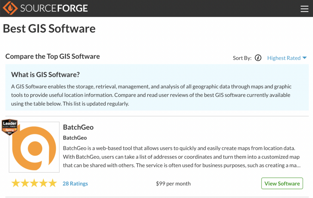
Reaching leader status is a significant feat. To earn this award, BatchGeo had to garner enough stellar user reviews to rank among the top 5% of the 100,000 products on SourceForge. This achievement highlights the exceptional quality and satisfaction that BatchGeo consistently provides to its users.
This is not the first time BatchGeo has been recognized, either. Recently it was ranked #1 in satisfaction and popularity by G2.
There are several features that help set BatchGeo apart:
- Upload CSV and Excel data
- Share maps easily with others
- Plan routes with multiple stops and options
- Filter specific data columns directly on your map
- Visualize addresses for marketing, travel planning, and sales tracking
Most GIS software requires a software download and specialized training. And still does not include the features that BatchGeo makes possible in the web browser.
“Easy to Use” and the “Best Way to Create Maps”
There is no larger software comparison directory than SourceForge (which serves nearly 20 million users every month). While the aggregate ratings are impressive, looking at individual reviews helps see what BatchGeo makes possible for users. Just as every map tells a story, there’s a rich experience inside every review.
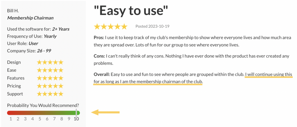
BatchGeo is highly praised for its ease of use and intuitive interface, making it accessible even for beginners. Users appreciate its ability to quickly upload and map data from CSV or spreadsheet files, which is particularly useful for organizing and visualizing locations for various purposes. The tool’s sharing capabilities allow maps to be easily distributed to others, enhancing collaboration.
Interactive Maps Made Easy
Sign Up Now“The best way to create maps! Simple, easy-to-use product, which is hard to find these days!”
— Austin N., Manager
Many users find BatchGeo valuable for planning routes, especially with its feature of grouping and using different colors for pins. The free version is noted to be feature-rich and sufficient for smaller organizations, while the paid version offers additional advantages for larger needs. Overall, BatchGeo is recognized for its efficiency, accuracy, and flexibility, making it a valuable tool for both personal and professional applications.
Create Your First Map for Free
Have you made it this far without making a map from your data? It’s free and all you need is a list of addresses or other locations. If you can copy and paste from one application to another, you have all the skills necessary to create your own map. Millions of SourceForge wouldn’t navigate you in the wrong direction. Create your first custom map!
