Author: Adam DuVander

Where the U.S. Guzzles the Most Water

The United States used 354,550.89 millions of gallons of water per day in 2010, and each state and county contributed very different amounts of water to that grand total. Even at the state level, water usage can be as individual as a fingerprint. We turned that individuality up a notch when we mapped the United States’ water usage at the county level.

View County Level Water Usage in a full screen map

The average county’s water usage was just under 110 millions of gallons per day. Curious to see which counties are way over or way under the average water usage, and what they’re using all that H2O for? Read on for details about the water usage of over 3,000 U.S. counties.

You Used How Much to Water the Lawn: Counties with the Highest Domestic Water Usage Per Capita

The domestic water usage is comprised of all the water used for home-related activities such as drinking, showering, watering plants, washing pets, etc. We were curious to see what the numbers would show us when we focused solely on domestic water usage per capita. We narrowed down the data to populations over 500,000 to see which large counties use a whole lot of water.

Interestingly enough, of the counties with populations higher than 500,000 people and high domestic water usage per capita, most are located in the Mountain States areas of Arizona, Nevada, Utah, and Colorado. This is likely because it doesn’t rain much in these Mountain States, so there’s not much help from the skies in the water department for plant watering and such. However, not every single county in the Mountain States uses up so much water. The following five largely populated counties guzzle lots more water domestically per capita than others so they may want to start setting a timer during their showers.

  • Hillsborough County, FL, 498 gallons/day
  • Arapahoe County, CO, 423 gallons/day
  • Clark County, NV, 326 gallons/day
  • Utah County, UT, 321 gallons/day
  • Polk County, FL, 319 gallons/day

Maricopa County in Arizona just narrowly missed the top five with a usage of 313 gallons per day.

We’re not too surprised to see Clark County on this list. The county is home to Las Vegas, where visitors come and use the water without being accounted for population-wise.

Florida counties make multiple appearances in the top five. The only non-mountain state on our list, Florida is a bit of an outlier. However, as you’ll read about later, Florida uses an incredible amount of water. In fact, the Sunshine State is one of the top contributors to the U.S.’s high total water usage.

Model Water Citizens: Counties with the Lowest Domestic Water Usage Per Capita

Now the above list doesn’t mean all U.S. counties are guzzling water in the home at alarming rates. Let’s give those top domestic water using counties something to strive for with the five highly populated counties with the lowest domestic water usage per capita:

  • Summit County, OH, 96 gallons/day
  • Delaware County, PA, 116 gallons/day
  • Allegheny County, PA, 120 gallons/day
  • Montgomery County, PA, 120 gallons/day
  • Jefferson County, KY, 120 gallons/day

While Pennsylvania may be looking impressive now, they seem even more so if we were to expand the top five to the top seven, as they also hold 6th and 7th place.

Guzzle Away: Counties with the Highest Total Water Usage

While we just showed you the highest and lowest domestic water users per capita, we also wanted to expose the highest overall water users. We’ll come to learn that these counties’ high total water usage is mainly due to non-domestic water uses such as thermoelectric power, mining, and irrigation.

The following five counties contributed the largest amount of water to the U.S.’s six-figure a day grand total in 2010:

  • Calvert County, MD, 3,265.38 Mgal/d
  • Los Angeles County, CA, 3,064.01 Mgal/d
  • Salem County, NJ, 3,054.08 Mgal/d
  • San Diego County, CA, 2,818.19 Mgal/d
  • Fresno County, CA, 2,813.24 Mgal/d

Read on to see what they used all those millions of gallons of water for.

Non-Domestic Water Usage

Calvert County, Maryland uses an unbelievable amount of water per day, although its domestic water use is a measly 4.72 Mgal/day or 149 gallons/day per capita. This leaves 3,257.96 Mgal/day in non-domestic water usage to get to its huge total of over 3,000 Mgal/day. We wanted to know what Calvert County was using all of that non-domestic water for, so we mapped the specific non-domestic water usages as well.

View Non-Domestic Water Use Specifics in a full screen map

What we found was that thermoelectric power is responsible for Calvert’s water usage. The county, not home to an extraordinarily large population with 88,737 people, uses about 3,258 millions of gallons per day on thermoelectric power alone. Thermoelectric power uses water to generate electricity through steam turbines in order to burn fossil fuels. And, in fact, thermoelectric power is one of the largest uses of water in the U.S. and in the world. Calvert’s use of thermoelectric power accounts for 99.8% of the county’s water usage, with only 0.1% of water being dedicated to domestic uses and the other 0.1% being used for public supply.

Coincidentally, the third highest total water using county on our list, Salem County, New Jersey, has an identical percentage makeup to that of Calvert County’s water usage. Like Calvert County, 99.8% of Salem County’s water usage goes towards non-domestic uses, such as thermoelectric power. Only 0.1% of Salem County’s water goes towards domestic uses and the final 0.1% is used for public supply.

Of course, we can’t forget about California. In fact, the Golden State has a bit of explaining to do. It’s notable that of the top five counties with the highest total water use, three of the five are counties located in California.

While three California counties are top water users, each county paints a very different picture when you delve deep into their water usage. And each county’s water usage is not exactly what you’d expect by looking at its population size. For example, teeny tiny Fresno, with a population of just 930,450 people, touts some big numbers when we take a closer look at its non-domestic water usage. In fact, the small county has an irrigation water usage of 2,492.77 Mgal/d, which is over 27 times greater than the highly populated L.A. County’s irrigation water usage.

Also of note is Los Angeles County’s mining focus. The county used 94.42 millions of gallons of water per day for mining. That is over 55 times more water than San Diego County used for the same reason, even with a roughly 6 million population difference. As for thermoelectric power, San Diego County beat out the much larger Los Angeles County with their 2,142.35 Mgal/d water usage to L.A.’s 1,361.35 Mgal/d. Fresno’s water usage towards thermoelectric power? A measly 0.62 Mgal/d.

All in all, these top three water using California counties use the majority of their water for non-domestic reasons such as irrigation, livestock, aquaculture, industrial, mining, and thermoelectric power. Los Angeles County uses 53.9% of its water towards these non-domestic purposes, 1.3% for domestic purposes, and 44.8% for its public water supply. San Diego County uses more of its water for non-domestic purposes with 82.3% of its water used non-domestically, 0.7% used for domestic reasons, and 17.1% for Public Supply. Fresno, comparatively, dedicates 90.6% to non-domestic uses, with most going to irrigation, 0.3% for domestic use, and 9.2% for public supply.

Calling out California – and other Top Water Users by State

Of course, when the counties of each state are added up, they show us that some states use way more water than others. Below are the five states with most total county water consumption:

California
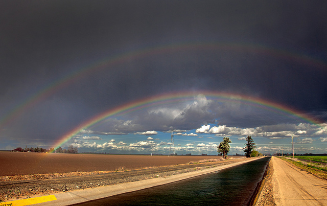
Photo by Robert Couse-Baker

The 58 counties of California total a water usage of over 37,962 million gallons per day. That 37,962 Mgal/d stems largely from irrigation to which the state contributes a little bit over 60% of its total water usage. Roughly 17% of the state’s total water usage goes towards thermoelectric power. California’s grand total for non-domestic water use is about 83%.

The state of California alone contributes to 11% of total withdrawals in all of the categories.

Texas
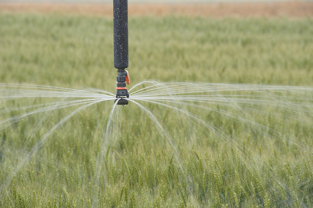
Photo by USDA NRCS Texas

The total water usage of the over 250 Texan counties is 24,796.69 millions of gallons a day. Some 11,120.1 Mgal/d goes to thermoelectric power or nearly 45%. A solid 27.6% goes to irrigation. Altogether, the Texan counties contribute 82.9% of their water to non-domestic usages.

Idaho

The 44 counties in Idaho use 17,230.47 Mgal/d. A whopping 98.2% of that water goes towards non-domestic things such as irrigation (81.5%) and aquaculture (16%).

Florida

The 67 counties of the Sunshine State use 14,935.97 Mgal/d. Florida, much like Texas, dedicates the majority of its water use to thermoelectric power. About 61.5% of its water goes to thermoelectric power to be exact. Irrigation takes up 19.5% of Florida’s massive water use. All in all, 83.4% of Florida’s water goes towards non-domestic related water usage.

California, Texas, Idaho, and Florida’s water usage together make up 25% of the entire United States’ water usage.

Illinois

The 102 counties of Illinois add up to 13,091.30 millions of gallons of water each day. Some 81.8% of that total stems from thermoelectric power. In total, 87.8% of the water used in Illinois each day goes to non-domestic purposes.

Together, the five states of California, Texas, Idaho, Florida, and Illinois account for 30% of the total water usage in the United States.


And there you have it, folks, all of the U.S.’s many counties mapped by water usage. However, if you’re less interested in water and more interested in beer, head on over to Where U.S. Beer is Brewed to see the top 10 U.S. states by brewery count.

Make a Map of Your Retailers or Sellers

The internet has made many things possible without leaving your device. You can order clothes, toys, household goods, and even groceries. Despite these e-commerce conveniences, most of life still takes place in the real world. People browse local shops to touch the merchandise and interact with their community.

There’s still a place for the online world within the offline world. People search the internet to determine where they’ll physically visit. Maps can help connect the virtual and real worlds, as you’ll see as we make a store locator map below.

View Example Map in a full screen map

A map like this is useful if you:

  • Sell products through retailers
  • Run multiple locations of a business
  • Use consignment or other sellers for your products

All you’ll need is the name and address of the physical stores, then you’ll be able to build a Google Maps store locator without code in just in a few clicks.

Organize Contacts in a Spreadsheet

The first thing you need is a list of places you want to map. You may already have this stored in a text file, a CRM, or maybe even on a piece of yellow lined paper. A really good way to store your list of locations is in a spreadsheet.

Create a new spreadsheet in Excel, Google Spreadsheets, or similar tool. Among the column headers you may want include:

  • Store name
  • Address
  • City name
  • State or province name
  • Country name

If you’re already using another tool, you may be able to export them into a spreadsheet format, such as converting a CRM to Excel.

Or start fresh and add the columns you want to track, and add in all your locations. When complete, it will look something like this:

When you have a spreadsheet full of locations, you’ll be ready to create your map.

Make a “Find a Retailer” Map

An Excel or other spreadsheet document is a great way to share data with others. Additionally, you can use it to track and sort your locations or retailers. And when it comes to creating a map, it’s as easy as copy-paste.

From within your spreadsheet program, highlight all your data, including the headers. Use Ctrl+C (Cmd+C on Mac) to copy the data. Then go to the spreadsheet mapping tool on the BatchGeo homepage and put the data in the main box using Ctrl+V (Cmd+V on Mac) to paste.

The video above walks through a basic map, or you can find a full Excel mapping tutorial that walks through step by step.

When you’re done, your map will look something like this:

View Retail Locations in a full screen map

There are only a few locations on this map, but you could have many more. Each row of your spreadsheet will be one marker on your map. Additionally, you can include other data about the location, such as a category of store, inventory, or anything else you’d find useful.

Add Store Type and Other Details

Now that you have a basic map of locations, you can expand the map to include other data. The additional information will be displayed within the box displayed when clicking a marker. You can also use map marker grouping to filter only the markers that match the data.

What sort of data would you use? One common choice is a category or type of store. For example, many companies sell into different types of retailers. A glue gun manufacturer may sell to hardware stores, supermarkets, and craft shops. You could add a column in your spreadsheet for the type of store.

Other fields you could add for the each store include:

  • A description of the store
  • The hours the store is open
  • Phone number(s) for the store
  • Neighborhood or other category-like information

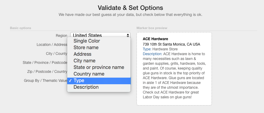
When you have your spreadsheet with the location and other columns of data ready, simply follow the copy-paste instructions above. This time, rather than clicking “Map Now,” you’ll want to “Validate & Set Options.”

Double check the location columns are correct, then click the “Group By” dropdown to select Type, Category, or similar group-able field. Now you’re ready to click “Make Map” and see a map like this appear:

View Retail Locations with Type in a full screen map

Notice that the store types determine the colors of the markers. You can click the options at the bottom of the map to filter only the types you select. This location browsing can be very useful for you, especially if you have many retailers. It can also be a great service to your customers, so you can help them find their nearest place to buy from you.

Publish the Map on Your Website

Installing a “Find a Retailer” or “Store Locator” on your website adds professional polish. It also helps your best customers buy more from you! Once you have a BatchGeo map created for all your sellers, it’s really easy to add it to your website.

Every time you create a map, you receive an email with a link to edit your map. Also in that email—and on the edit page—you’ll find “Embed Code.” This is some HTML you can use in any website to easily include your map within your existing website.

All you need to do is create a new page or choose an existing retailers page. Then copy-paste the Embed Code to your website.

Add a Search Box

Each BatchGeo map comes with its own search box in the upper right hand corner. You can use it to enter a city, postal code, or full address to search the map for the closest location.

In addition, you can include a search box without a map anywhere on your website. From the same map editing page, choose “Locator Code” and copy-paste that into a single page on your website, or a header/footer template to include it on every page. Let your customers find a retailer or store location from anywhere on your site!

A Map For All Your Data

Now that you’ve created a map of store locations, what other spreadsheets or lists of addresses could you make geographic. Get customers or leads on a map, perform geographic data analysis, or simply map your address book to see where all your friends live.

All you need is a simple spreadsheet with addresses, and we’ll turn that into a useful map. Make your first map today!

Tour de France: Winners & Route Mapped

Each year in July, over one hundred serious cyclists gather together in France to compete in an endurance race, the Tour de France. The event takes more than three weeks, as the route covers 2,200 miles (3,500 km). It’s definitely no small feat to be be the first to cross the final finish line, although some countries are more familiar with their cyclists winning the title than others.

View Tour de France Winners in a full screen map

Click around on the map above to see which countries have won the Tour de France so many times it will make your wheels spin, or read on for highlights about the winners and the 2018 route mapped.

Pump Those Brakes, How Many Times Has France Won?

Many countries send their most talented cyclists to France each year in the hopes of being Tour de France champions. The following countries have had the most success at the race:

  • France, 36 wins
  • Belgium, 18 wins
  • Spain, 12 wins

The Tour de France is just that, a Tour of France. It should then come as no surprise to learn that the French have won the competition more times than any other country in the world. With 36 wins under its belt, France is clearly pedaling in a different gear than the rest of the world. Perhaps even more amazing is the fact that 21 of those 36 wins were from different cyclists. There is clearly something in the water in France that produces not just one all-star cycler but many. However, the country is in the middle of a slight dry spell. The last time France won the competition was 33 years ago in 1985.

Belgium has won the second-most amount of Tours. While nowhere near as many wins as France, Belgium’s 18 wins are still notable. Impressively, 10 out of those 18 wins were all won by separate cyclists. Belgium last won the Tour in 1976.

Spain has won the Tour de France 12 times with seven different riders. Their last win was in 2009, which is much more recent than France and Belgium. However, if all of these top winning countries haven’t won in the past eight years, who has been winning the Tour de France lately? Well, since 2012, Great Britain has won every Tour de France save for 2014 when Italy snagged first place. So, in the past six years, Great Britain has won five competitions.

Wheelie, Wheelie Big Winners

As for the individual cyclists who did the grunt work of cycling nearly every day for over three weeks? There are five cyclists who at one point won the Tour de France five or more times.

  • Lance Armstrong, 7-time winner (disqualified)
  • Bernard Hinault, 5-time winner
  • Eddy Merckx, 5-time winner
  • Jacques Anquetil, 5-time winner
  • Miguel Indurain, 5-time winner

Lance Armstrong is perhaps the most controversial cyclist in history. While his wins have been denounced and reallocated to the runners-up, at one point the whole world believed he won seven consecutive Tour de France tournaments. Armstrong initially won the competition for the U.S. in 1999, 2000, 2001, 2002, 2003, 2004, and 2005 before he was stripped of all titles due to doping.

Bernard Hinault, unlike Armstrong, is still considered a Tour de France winner, and a pretty talented one at that. With Armstrong’s disqualification, Hinault is one of the four cyclists to officially tie for the most Tour de France wins. Hinault won the Tour for France four consecutive times in 1978, 1979, 1981, and 1982. He lost in ‘83 and ‘84, only to make a staggering final comeback in 1985 with his last win for France.

Eddy Merckx, also with five Tour de France wins, is a Belgian cyclist who won the competition for his country in four consecutive Tours in 1969, 1970, 1971, and 1972. He did not win in ‘73 but came back to win the 1974 competition. Jacques Anquetil, another Frenchman, won the Tour in 1957, and then again consecutively from 1961 to 1964. The Spanish cyclist Miguel Indurain won the competition for five years straight starting in 1991.

Because Lance Armstrong doesn’t really count, we’ll add in the next highest winner to replace him. Chris Froome is a British rider with four wins under his belt. He is the reason for Great Britain’s most recent domination of the Tour de France, winning the competition for them in 2013, 2015, 2016, and is the current title holder having won in 2017. Will he win again this year?

A Vicious Cycle: Cheating Throughout the Tour

Avid Tour de France fans know all about the cheating scandals that rocked the races. In fact, there are five cheating scandals you should know about that explain why official Tour de France reports vary regarding how many times a country has won. Some countries, once a Tour winner has been implicated in doping and subsequently disqualified, refuse to give their title back.

You already know about Lance Armstrong, but let’s hear about the others with rescinded wins and tarnished reputations due to doping scandals.

Bjarne Riis is one of the first cyclists who won the Tour but who was then disqualified. Riis is Denmark’s only Tour de France champion from way back in 1996. So you’d understand why they’d have a tough time giving up their one and only title just because Riis admitted to cheating in 2007. Over ten years after his big Tour de France win, Riis admitted to having used performance-enhancing drugs during the 1996 Tour. The Tour de France rescinded his win, and Jan Ullrich of Germany was proclaimed the new 1996 winner. However, in 2008, the Tour gave him back the W, likely because of just how much time had passed since his win. However, that reinstated W* was forever followed by an asterisk to ensure everyone would always know it was a tarnished victory.

Because the Tour reinstated Riis’s win, Jan Ullrich is no longer considered to be the winner of the 1996 Tour. Though Ullrich, the German-born cycler, did officially earn Germany its only first-place status the year after the Riis fiasco in 1997. However, Ullrich’s reputation is not as squeaky-clean as you’d expect of someone who kind-of sort-of won the 1996 Tour de France due to the original winner’s drug use. In fact, Ullrich himself has had some trouble with PEDs, although it didn’t have any effect on his 1997 win. In 2006, Ullrich was banned from competing in the Tour de France pending an investigation into whether or not he was familiar with using PEDs in recent years. He was found guilty of PED use in 2012 and admitted it in 2013. Ullrich’s admittance has had no effect on his second-place but kind-of first-place status in 1996 and actual win in 1997.

In addition to Armstrong, Riis, and Ullrich, two more cyclists have has run-ins with the law when it comes to PEDs during the Tour. Both Floyd Landis, an American cycler, and Alberto Contador from Spain had titles rescinded due to doping. Landis doped in 2006, and the runner-up, Óscar Pereiro from Spain is officially considered the winner. However, Pereiro’s win didn’t give Spain much of a leg up in wins because, in 2010, Alberto Contador lost the Tour de France win for Spain due to doping.

Tour de France: 2018 Route

The Tour de France lasts a grueling 21 days, with only two days of rest. A mixture of terrain types from nice and flat and hilly to mountainous keeps the cyclists on their toes. More so than just the variety of terrains, the competition throws in a blend of Team Timed-trials and Individual Timed-trials so the Tour is never the same from day to day. It is also not the same from year to year, so we thought we’d map this year’s 2018 Tour de France route.

View 2018 Tour de France Route in a full screen map

Follow along by stage on the map above to get a feel for just how much land these cyclers cover in an attempt to take home the W for their country.

The cyclists are on the move from their very first point signaling the beginning of the yearly Tour on Saturday, July 7 in Noirmoutier-en-l’Île and traveling their way around France’s borders to the Tour’s finish line on Sunday, July 29, in Paris Champs-Élysées. Of the two rest days they get in between, the first occurs ten days after the start of the Tour on Monday, July 16th, in Annecy. Seven days after that comes the second rest day on Monday, July 23rd in Carcassonne, France. Note that the insane amount of kilometers traveled from Stage 9 to Stage 10 is traveled by plane, just as with Stage 20 to the finish line at Stage 21.


And there you have it, folks! The Tour de France’s biggest winners and the route the 2018 competitors will take very soon, all on a map. Who will win in 2018? Watch the Tour de France in July to find out. And, if you’re just slightly under the Tour de France’s level, you can still map your own neighborhood bike path today with BatchGeo in seconds.