Hiking Highlights from the Pacific Crest Trail on a Map
The Pacific Crest Trail or PCT is a hiking trail that passes through three states, including California, Oregon, and Washington and even has hiking highlights straight into Canada. Hiking the entirety of the trail will rack up 2,659 miles on a Fitbit, making the PCT 500 miles longer than the Appalachian Trail. Moreso than just being longer, a hike up the PCT may test a hiker’s ability to survive harsher weather conditions than one would face while hiking the Appalachian Trail, which is all forest all the time. The PCT, which begins in the Mojave desert and moves up into snow at the Sierra Nevada Mountains, on to the Cascade Mountains, and then back to more desert, glaciers and finally to forest is known for its extreme changes in weather and terrain, which makes it all the more difficult to hike.
View Hiking Highlights from the Pacific Crest Trail in a full screen map
Experience what it’s like to hike the trail yourself on the map above. You can sort by type of hiking highlight, state, elevation, or elevation change, or you can just read on for insights on hiking the Pacific Crest Trail.
Types of Hiking Highlights
There are many types of hiking highlights to encounter if you choose to hike the nearly 2,700 miles of the PCT. From volcanoes to national forests, parks to beautiful lakes, the Pacific Crest Trail leaves nothing to be desired for those who want to see all of the beauty nature has to offer in one fell swoop.
Cities, Parks, and Trails
Hiking along the Pacific Crest Trail, you will find four cities, including two CDPs or census-designated places. Both Agua Dulce and Campo are located in California, and as CDPs, they resemble cities but lack incorporation or any sort of municipal government. Places like Agua Dulce and Campo, among other census-designated places, have been used since 1980 in the U.S. Census Bureau to gather data for the U.S. census.
The other two cities you’ll find hiking along the PCT are just your typical, everyday cities: Cascade Locks in Oregon and Stehekin in Washington. Stop by to get much-needed necessities for the rough terrain and weather changes you’re bound to encounter while hiking the PCT.
Interactive Maps Made Easy
Sign Up NowThere are also a total of 13 parks you may come across on the PCT. Six of those parks are national parks, which include:
- Kings Canyon National Park
- Yosemite National Park
- Lassen Volcanic National Park
- Crater Lake National Park
- Mount Rainier National Park
- North Cascades National Park
There are also three state parks along the PCT:
- Mount San Jacinto State Park
- Anza-Borrego Desert State Park
- McArthur-Burney Falls Memorial State Park
Finally, there are two trails along the PCT:
- Windy Gap Trail, located in Angeles National Forest, which starts in Crystal Lake Recreation Area, another park on our list.
- Kendall Katwalk
Mountain Passes and Mountains
Hiking the PCT, you can also find 13 mountain passes, which are navigable routes through mountain ranges, and five mountains, three of which are actually volcanoes:
Mount Thielsen
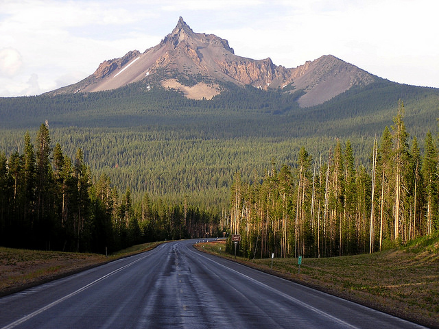
Mount Thielsen, a volcano whose last known eruption occurred 250,000 years ago, is located in the Oregon High Cascades. The glaciers that have formed around the volcano have created a horn-like peak, hence it’s other nickname, Big Cowhorn. Those same glaciers on and around it have made it a prime skiing and hiking destination.
Mount Adams
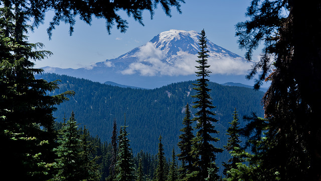
Mount Adams, located in Washington, is the only potentially active volcano along the Pacific Crest Trail. Although it has not erupted in more than 1,000 years, it is not considered extinct. A 1,000-year gap is nothing compared to Mount Thielsen’s 250,000 year gap. In addition to being the only volcano considered to still be active on our list, Mount Adams is also the second highest mountain in Washington after Mount Rainier.
Glacier Peak
Glacier Peak is visible from Seattle and located in Washington. The fourth tallest of all of Washington’s peaks, it is also the most active of Washinton’s volcanoes. Glacier Peak has produced the largest and most explosive eruptions in the state and has erupted five times in past 3,000 years.
National Forests and Lakes
There are also 12 National Forests throughout the 2,700 miles of the Pacific Crest Trail:
- Cleveland National Forest
- Angeles National Forest
- Lassen National Forest
- Shasta-Trinity National Forest
- Rogue River National Forest
- Umpqua National Forest
- Willamette National Forest
- Deschutes National Forest
- Mount Hood National Forest
- Gifford Pinchot National Forest
- Mount Baker-Snoqualmie National Forest
- Okanogan National Forest
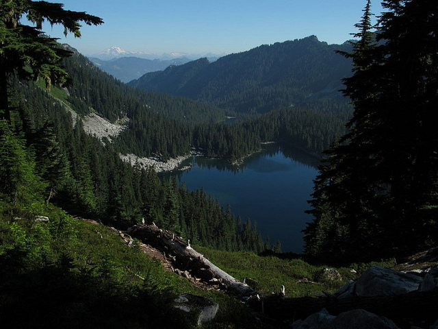
And three lakes:
- Big Bear Lake
- Crater Lake
- Waldo Lake
Wildernesses and Other Landmarks
There are 24 Wildernesses, or beautiful natural environments that have not been touched by any sort of human activity, as well as plenty of other landmarks such as:
- Devils Postpile National Monument
- Tuolumne Meadows
- Cascade–Siskiyou National Monument
- Dee Wright Observatory
- Olallie Scenic Area
- Warm Springs Indian Reservation
- Timberline Lodge
- Columbia River Gorge
- Bridge of the Gods
Largest Elevation Changes Throughout the PCT
In addition to all of the highlights you’ll find hiking the PCT, there are some other notable facts of interest about the trail, such as the largest elevation changes within each state of the PCT.
The largest elevation change in California involves hiking from Kings Canyon National Park to Forester Pass. Between the two, there is a 2,600-meter elevation change. This makes sense seeing as Kings Canyon is just that, a canyon in the form of a national park, while Forester Pass is a mountain pass.
Hiking from Mount Hood National Forest to the next hiking highlight on the PCT, the Olallie Scenic Area, results in a huge elevation change. This transition will leave you with the largest elevation change in Oregon at -1,574 meters.
The largest elevation change in Washington involves hiking the section of the Pacific Crest Trail that moves from White Pass to Mount Rainer National Park. This part of the trail results in a 2,735-meter elevation change.
The largest (and only!) elevation change in Canada means hiking through the last two hiking highlights on the trail, from Okanogan National Forest in Washinton to E. C. Manning Provincial Park in B.C. Canada. This last little bit of the trail results in a 395-meter elevation change.
Interactive Maps Made Easy
Sign Up NowHighest and Lowest Points Along the Pacific Crest Trail
In addition to largest elevation changes throughout each state, knowing the highest and lowest points throughout the trail may be helpful in knowing when to really start downing those granola bars and powering up for a steep hike up or down.
More than accounting for the largest elevation change in California, Forester Pass is also the highest point along the PCT. Coming in at 4,014 meters, this mountain pass will surely leave your legs aching.
On the opposite end of the spectrum, Cascade Locks in Oregon corresponds to the lowest point on the PCT. At 59 meters, this city is so far below Forester Pass it’s crazy to think they’re both located on the same trail.
If you’re not ready to hike the PCT yet, we understand. You can always make your own map of the trail today, hitting the hiking highlights most interesting to you.
