Google Maps vs Mapbox vs BatchGeo on Pricing and Features
The very best way to display location data is on a map. You can see patterns visually before you’d ever understand them in data. The human brain is built for spatial relation, so we can use geographic visualization to help people understand proximity, plan routes, and make decisions. It’s no wonder that web and mobile maps have gained in popularity and usage in recent years. Customers have come to expect a map-based interface for location results.
Making maps for your website or mobile app does not need to be difficult, nor expensive. Among the platforms you can use to create maps are Google Maps, Mapbox, and BatchGeo. Based on your needs and volume of usage, the pricing can range from free to hundreds or even thousands per month,
In this article, we’ll look at Google Maps pricing compared to Mapbox and BatchGeo across various levels of usage. We’ll also break the price down by the two most common ways to use location data: to display maps and to perform address geocoding.
You’ll see that, despite some “free” usage at low levels, Google Maps and Mapbox quickly become expensive with their usage-based pricing. The simple pricing of BatchGeo, plus its additional features like Excel integration and code-free implementation, make it preferable to these geographic juggernauts.
Map Display Pricing by Volume
For many years, the standard Google Maps API was completely free. Developers could create and display as many maps as they wanted. And many did, which led to an uproar when the company began charging in 2011. Around the same time, Mapbox was founded to provide an alternative to Google Maps based on OpenStreetMap data.
The table below shows the cost to display maps on a web page or in a mobile app (per 1,000 views) at various numbers of views per month.
| 50,000 | 250,000 | 500,000 | |
|---|---|---|---|
| Google Maps | $3 | $6 | $7 |
| MapBox | $0 | $3 | $3 |
| BatchGeo Pro | $4 | $4 | $4 |
Interactive Maps Made Easy
Sign Up NowEach provider has a defined amount of free usage:
- Google Maps offers $200 per month across its Maps Platform, which translates to about 25,000 map views without charge. The $200 discount is included in the numbers in the table.
- Mapbox includes about double the amount of free usage, not charging for the first 50,000 map views.
- BatchGeo is free for maps up to 250 locations with limited views
To create a Google Maps or Mapbox map, you’ll likely need to write some code. Both provide SDKs for JavaScript, which can be used to embed the map into a web page. You’ll either need a programming background yourself or will have to hire a web developer to add Google Maps or Mapbox to your website.
BatchGeo provides an easier way to embed maps on the web without writing any code. Using a simple Excel spreadsheet or comma-separated values (CSV) file, you can copy-paste or upload location data. Then, after declaring a few options, BatchGeo builds embeddable maps automatically.
Regardless of the map platform you use, you’ll need to use a geocoder in addition to display maps. Google Maps and Mapbox charge for it separately, as shown in the next section.
Geocoder Pricing by Volume
Displaying a map is only half of the equation if you have addresses that need to be added to a map. Google Maps, Mapbox, and BatchGeo all offer geocoding to convert human-readable locations into coordinates to plot on a map. As with display maps, there is free usage and some other terms to consider.
The table below shows the cost to geocode (per 1,000 geocodes) at various numbers of geocodes per month.
| 50000 | 250000 | 500000 | |
|---|---|---|---|
| Google Maps | $1 | $4 | $5 |
| MapBox | $5 | $5 | $5 |
| BatchGeo Pro | $0.30 | $0.40 | $0.39 |
Something to consider with geocoding APIs is that you may come up against rate limits. Both Google Maps and Mapbox restrict the number of geocode requests that can happen during a period of time. Google Maps usage limits are 50 per second. Mapbox is more restrictive, with only 600 per minute allowed. BatchGeo allows up 25,000 geocodes per map and will automatically run them 100 geocodes at a time.
In addition to writing the code to access the Google Maps or Mapbox geocoding APIs, you’ll need to make sure your code handles caching and rate limiting. As with display maps, BatchGeo handles every aspect of geocoding when you upload or copy your location data to our mapping and geocoding tool.
Finally, a note on combined pricing: there is some potential undercounting for Google Maps and over-counting for BatchGeo. Google Maps $200 free usage also applies to geocoding, but it can only be used once per month. The two tables in this article each count the discount. Depending on your usage, the actual cost of Google Maps may be slightly (or substantially) more.
BatchGeo pricing is inclusive of both map views and geocodes, with the larger usage determining the price. That can make the already-inexpensive BatchGeo look even more affordable. In the next section, you’ll see what else is included in the BatchGeo Pro monthly pricing.
BatchGeo: Easy Maps with Advanced Features
For many map projects, BatchGeo is easier to create and cheaper to operate. Depending on your usage level of display maps and geocoding, you could save hundreds or thousands of dollars by using BatchGeo. In addition, your maps will automatically include handy tools you’d otherwise need to code yourself.
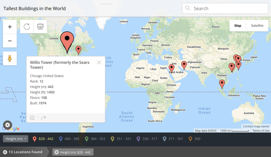
Each BatchGeo map can include additional data about each location, so you can visualize other data in your spreadsheet. Display the name in a box when each marker is clicked, and filter which markers are displayed with built-in data grouping.
Interactive Maps Made Easy
Sign Up NowTo achieve a similar approach with the Google Maps or Mapbox display APIs, you’d need to write a lot of additional code. And this is only one of several BatchGeo features, which includes custom colors, different map styles, and mobile access for your entire team.
If you wish to provide a store locator map (to discover your multiple locations or retailers who carry your product), you’ll save a bunch of time with BatchGeo. A location finder and full text search can be included with every BatchGeo map. Simply enable the store locator, with either a left-side or below-map list of locations, when you create or edit your map.
Finally, you can embed any map seamlessly into your own site. Similar to sharing a YouTube video, you just copy some simple HTML code and paste it where you want the map to be displayed. The embedded map is fully functional and completely interactive, with a much richer “out of the box” experience than Google Maps or Mapbox. And all without coding, for a much lower price.
Try BatchGeo for free and add your data to create a map today. We’ll do all the mapping and geocoding for you (no code, rate limits, or coordinate refreshes). Then pay one monthly price that stays affordable as you grow.
