Flashcard Maps: Learn US State Capitals, Flowers, and Birds
Students in primary school all over learn geography. In the United States, one common practice is to memorize state capitals. Though many of us forget them, it’s never too late to re-learn your geography. Let BatchGeo help you with this flash card map—or make your own. In addition to capitals, we’ve included state flowers and birds, so those who already remember capitals can have something new to learn.
View State Capitals Flash Cards in a full screen map
Those outside the U.S., or anyone who doesn’t card about northern cardinals and white prairie roses, can easily make their own geography flashcards using BatchGeo. We’ll show you how below.
First, let’s see how this flashcard map works. Zoom in and identify a state (that’s another geography quiz, though Google Maps gives you hints with labels). Click the marker over the state—we put them at the geographic center so as not to let city labels give away the capital. You’ll activate an info box above the marker with the answer.
To test yourself on the bird for that state, click the right arrow near the bottom of the info box. Click the arrow again for the state’s flower. The video above shows the flash cards in action, as well as a way to filter out one of the tests using the grouping functionality that comes with every BatchGeo map.
If you’re a guesser, here’s how to increase your odds:
- For southern states, choose northern mockingbirds—northern is relative and fives states share this bird.
- For more northern states, but not New England, go for the northern cardinal, the top choice with seven states claiming this red bird.
- For those west of the Mississippi River, you’re best guessing the western meadowlark, the official bird of six states.
As for flowers, you’re on your own, but these are claimed by at least two states: violet (3), apple blossom, mountain laurel, wild prairie rose, goldenrod, and magnolia.
Interactive Maps Made Easy
Sign Up NowThe tradition of a state flower appears to be older than choosing a state bird. The oldest state flower is Washington’s Coast rhododendron, established in 1892, just three years after Washington became a state. Six other states added official flowers before 1900. By contrast, over half of the states already had state flowers when state birds became a thing. The earliest state bird was in 1927, when seven states added official birds.
How to Make Your Own Geography Flashcards
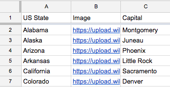 Are you ready to make your own flashcard map? Whether for testing yourself, your kids, or your students, these are fun and easy to make. To start, all you need is a spreadsheet with a geographic location (country, state, or city name) and a column for at least one answer. Optionally, you can also include an image URL to help visual thinkers commit the answer to memory. See our power user tips to learn how to add images and more.
Now simply highlight every row/column of your spreadsheet (remember the header row!) and paste it into the big data box on the BatchGeo home page.
If you’d like to see how we created multiple categories in a single map, feel free to view the spreadsheet we used. For ideas on finding or preparing your data, be sure to check out our open data mapping guide.
