How Print a Custom Google Map
Did you know that you can print your own BatchGeo maps? All you need is data you’d like to map and a free BatchGeo account or, for a higher-quality image, a BatchGeo Pro account. With that, you’ll be able to print hard copies of your maps four different ways for your easy access or to share with others.
View Neighborhood Garage Sale in a full screen map
For example, we might print the neighborhood garage sale map above so that we could share it with eager second-hand shoppers. The hard copy will help everyone navigate the sale more easily. There are all sorts of situations that call for printed maps and the benefits of having a hard copy.
Why Print Your Map?
The digital version of your BatchGeo map is accessible on the web or via your mobile device. However, if you find yourself without wifi or cellular data, a printed map can be a lifesaver. Printed maps may also be useful for those who don’t have regular access to computers or cell phones, as well as the less tech-savvy among us who prefer paper versions. But even if you’re Bill Gates’ nephew, you can still find yourself in a situation where a hard copy of your map is more useful than one that lives on the web. Here are some examples of such situations:
- Pinning a local crime map to your community’s bulletin board
- Sharing a wedding map guide with your guests
- Highlighting your favorite places in the neighborhood with guests
And there are many more uses for a printed map. But first, you must make your map!
Make a Map From Your Data
You’ve come to the wise conclusion that you can no longer live without a printed Google Map made with BatchGeo and the first step is to make your map. To do so, gather the data you’d like mapped into a spreadsheet. Be sure to include headers and separate columns for any location data such as city or state. Then, to make a map from your data:
- Open your spreadsheet
- Select (Ctrl+A or Cmd+A) and copy (Ctrl+C or Cmd+C) all your data
- Open your web browser and go to batchgeo.com
- Click on the location data box with the example data in it, then paste (Ctrl+V or Cmd+V) your own data
- Check to make sure you have the proper location data columns available by clicking “Validate and Set Options”
- Select the proper location column from each drop-down
- Click “Make Map” and watch as the geocoder performs its process
Interactive Maps Made Easy
Sign Up NowOnce you’ve made your map, you can customize its markers and design. You have the option to choose from seven to 10 different location marker colors, depending on which version of BatchGeo you have. In both versions, you can select from one of three marker shapes and you can also customize the base map style with the five different options. Once your map looks exactly the way you want it, it’s time to print.
4 Ways to Print Your Map
There are four ways to print your maps made with BatchGeo. You may have access to one or all of these printing options depending on if you use the free version or if you’ve upgraded to BatchGeo Pro.
Printing For Free Users
If you’re a free BatchGeo user, you can utilize the print function of your web browsers in order to print your maps. In most web browsers, this is accessible via File → Print. You would then proceed with your usual steps for printing on your computer.
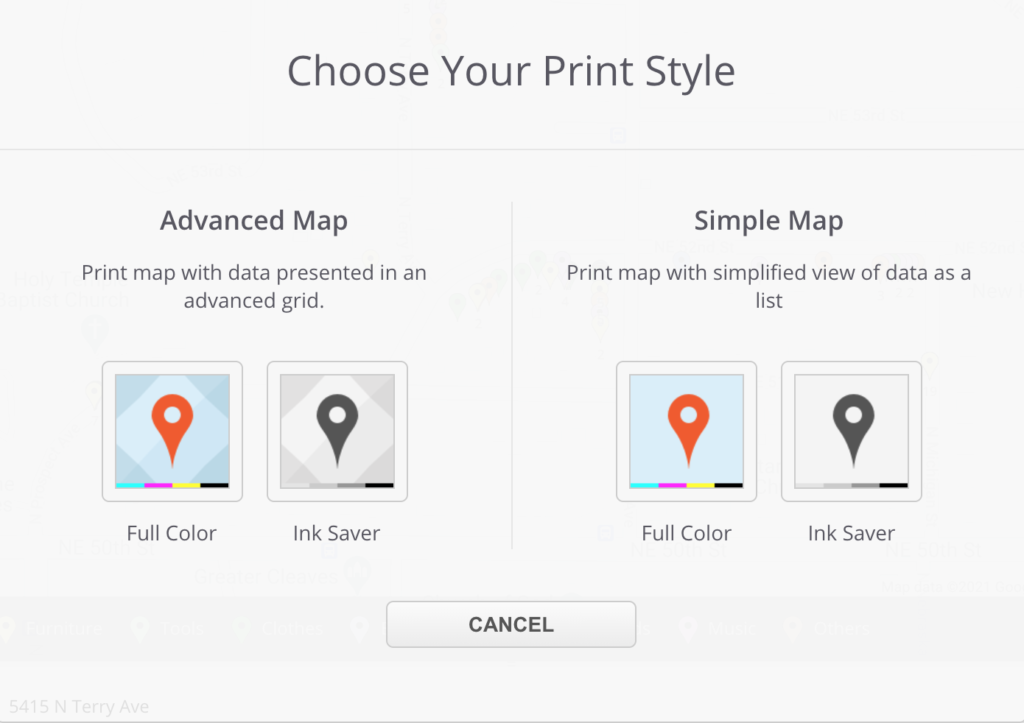
Another way to print as a free user involves right-clicking your map, selecting the Print option, and choosing between two print styles: Advanced or Simple.

Quick Multi-Print For Pro Users
As a BatchGeo Pro user, you gain access to higher-quality printed maps via exporting. Exporting maps results in better quality than printing directly from your browser. Multiple maps can be exported and printed quickly by navigating to the My Maps page and locating the map you wish to print. Click on the PDF or the Image button to the right of the map’s title to export your map into a high-quality PDF or PNG Image file.
Since we’re focusing on printing, a PDF file may be your best bet if you wish to print your map. However, if you’re looking to upload your map image online, a PNG Image file will be better. Your web browser will determine if the exported PDF or PNG file will be downloaded or display right in your web browser. Either way, the universal language of printing (File → Print) will work to print your exported map.
Advanced Printing For Pros
For another way to get even better quality printed maps, BatchGeo Pro users have the advanced option to print. Unlike the quick-print option, advanced printing allows you to control both the size and the zoom of your map image.
To print the entire map or a zoomed-in map:

- Open up your map
- Optional: Zoom in on the section of the map you’d like to be printed
- Right-click on your map within the BatchGeo web browser
- Click Export PDF / Image
- Under the Image Export Format, select either PDF or PNG Image
- Under Image Size, select one of the two sizing options: Match Window Size or High Res 11” x 17” Printout
A clear, high-quality PNG image of your map will be downloaded to your computer, and from there you can print it as you normally do.

The four different ways of printing your map highlight the “pros” of BatchGeo Pro. However, the free version of BatchGeo still comes with incredible amounts of useful features to use with your maps, such as map grouping and map badges. No matter which version of BatchGeo you elect to use, map-making has never been easier.
