Your Map Data To Go On Any iPhone or iPad
Wherever you are, you can view, filter, and search your maps faster than ever before. We have completely updated BatchGeo Mobile, our native iOS app for accessing your maps. You can now use any iOS device and see the same great interface to your map data that you’ve come to expect with BatchGeo.

Among the improvements we’ve added to BatchGeo Mobile are:
- Updated to support the latest versions of iOS 10
- Added Google Maps rendering for a consistent, fast look
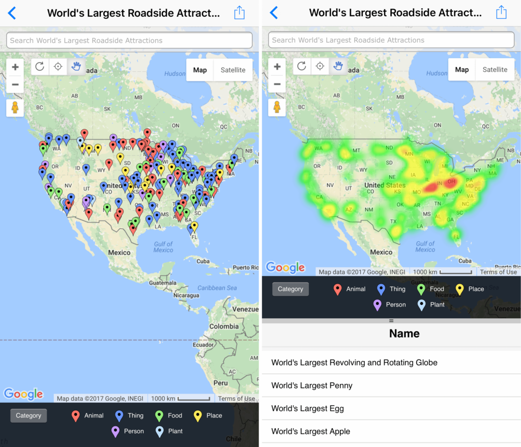
- Included our advanced mode features like heat map and data view
The latest enhancements for BatchGeo Mobile make it an even better choice for on-the-go maps. Use the GPS-enabled app for customer visits, sales maps, or other data you want to access anywhere.
Google Maps: Filter, Zoom, Select
As with the web version of BatchGeo, the iOS app now is built upon the industry-leading Google Maps platform. We’ve taken a speed-first approach, ensuring you can see your map and data as quickly as possible. To orient you easily, we’ve modeled the interface after the web version, so you know exactly how to use your data, no matter where you are.

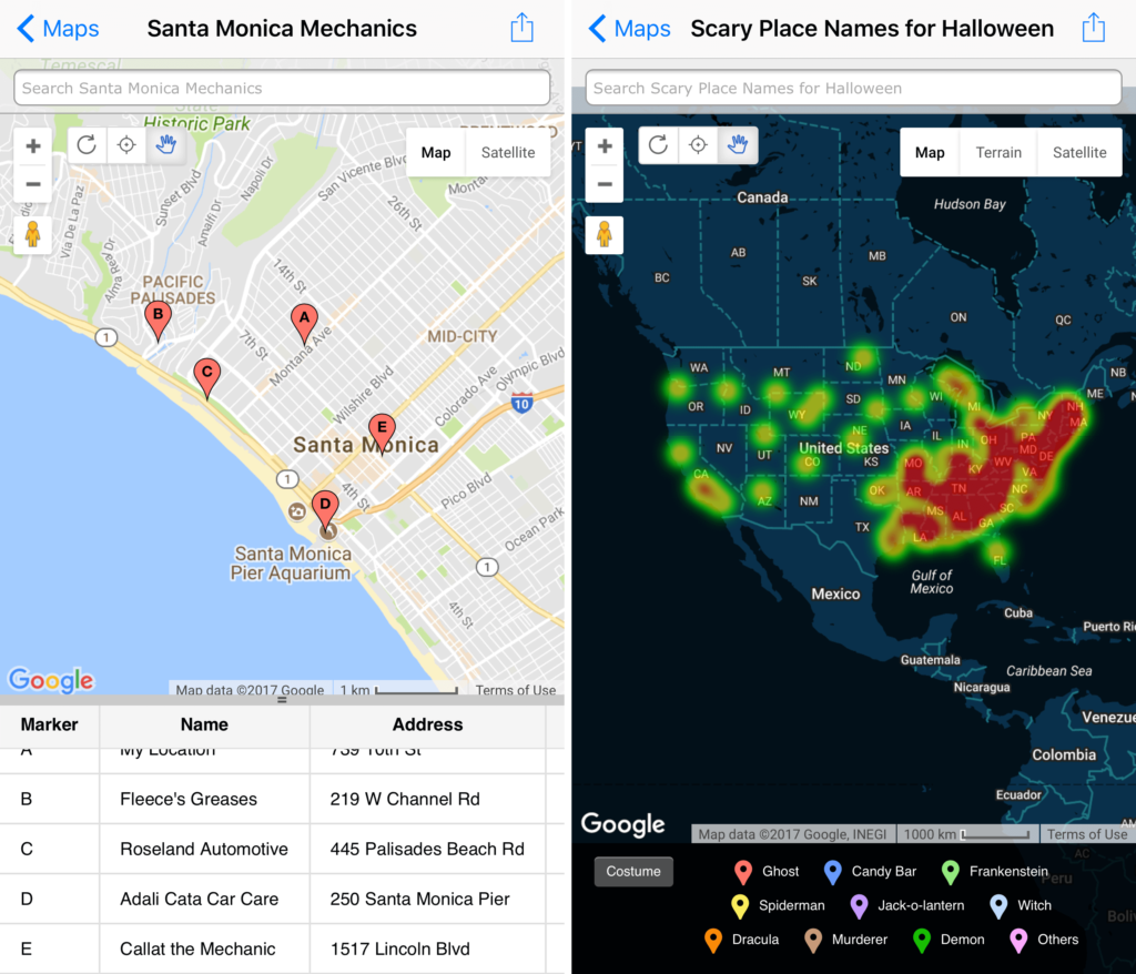
Use the powerful grouping feature to drill down at a specific subset of your data. Non-location columns in your spreadsheet are available to filter your map by category values or numeric ranges. Maps with thousands of locations can keep you focused when you select just the fields you need to see in the moment. Pair this with your current GPS location, and you’ll see what’s important in any locale.
Find your nearest marker, search across the data, or drag and zoom your way to what you seek. Tap a marker to see its underlying data. BatchGeo Mobile means fast access to your own data.
BatchGeo Pro: Advanced Mode for Your Whole Team
The new version of BatchGeo Mobile also makes our popular advanced mode available on your iOS device. Visualize your data with heat maps, a layer that shows the density of your markers to show the “hot spots.” Or check out the details in your data with a spreadsheet-like view that takes you to each location in a click.
Interactive Maps Made Easy
Sign Up Now
You may have noticed that maps with many markers end up communicating density through the overlap of markers. Additionally, you can use clustering to aggregate and visualize underlying data. But neither of those quite get the story within the data across like a heat map. Our algorithm calculates the areas of highest density, then layers a partially-transparent visual over the map so you can see the underlying areas. Our customers frequently identify new insights with this view at their own data.
On the other end of the spectrum is data view, which helps BatchGeo Pro users dig into the details within their data. Use data view to take a quick look into tabular data akin to a spreadsheet. Sort by any field to find the best and worst in a category, then tap a row to see it quickly appear on the map above.
To turn on either of these features, tap and hold on your map, then select the option you’d like to enable. Inspect your locations with data view and make it come to life with heat maps.
Share Maps Across Web and Mobile
We think you’ll enjoy BatchGeo Mobile so much, you’ll want everyone on your team to see the world the way you do. That’s why we’ve built sharing into the app from the start. Some improvements in the latest version make it even more useful.

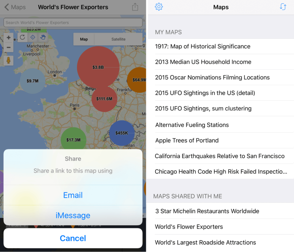
Filter your map list to distinguish your personal maps from those the rest of the team is sharing. That way, you always know whose map is whose.
Even better, sharing maps with others is simpler than ever. Now BatchGeo Mobile supports both email and the native iMessage platform to send links to shared maps. You’ll save your team time and always have maps at your fingertips.
Try BatchGeo Mobile Today
BatchGeo Mobile is faster than ever, with a consistent look powered by Google Maps. Take advantage of grouping data, heat mapping, sharing, and more. Download BatchGeo Mobile today and access your maps wherever you go.
