Maps now optimized for IPhone and Android

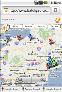
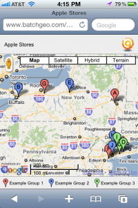
We spent some time recently to update our mapping capabilities to work better on the IPhone and Android platforms. Now when you look at a BatchGeo map on these platforms, the display will be sized appropriately. Also it will use the phone’s GPS to find the nearest location on the map, if you are interested in that.

BatchGeo now has an optimized experience for the IPhone platformBatchGeo now has an optimized experience for the Android platform

We will be looking at other platforms in the future including Blackberry and the new Windows Phone 7 OS. Your feedback is appreciated, please feel free to post your experiences here.

Printing issues – a new fix is in

We’ve talked about printing issues before, now it appears that we have found a fix that should work for enabling printing in all browsers. I am hopeful that this will solve problems once and for all, but please try for yourself and post your results here.

Google requests disabling of geocoding output

Google has officially requested that we disable some elements of our site that allow users to extract geocoded coordinates in bulk. It is in violation of their Terms of Service agreement. Many of the rules in the TOS are requirements of third party data providers that do not like their data being accessible outside of whichever system they have licensed it to.

I find this an unfortunate turn of events, but from our stats I recognize the majority of users do not use the geocoding export feature but rather keep their data hosted on BatchGeo by saving their map.  We will of course continue to offer free map hosting to all interested, and look forward to rolling out more features all of the time to keep our users happy.

BatchGeo is still the quickest way to make a map!